
A fast-moving storm rolled through with gusty winds and white-out conditions, following a nearly straight line from west to east across upstate New York and northern New England. Upwards of 5-10″ of snow fell on portions of the Adirondacks, Green Mountains, and areas of upstate New York.
The downstate NY region didn’t receive much snow, but the cooler weather is a reminder that winter is still out there. Good skiing is only a few hours away.
How much snow did the region get? Here’s the 24-hour snowfall totals:
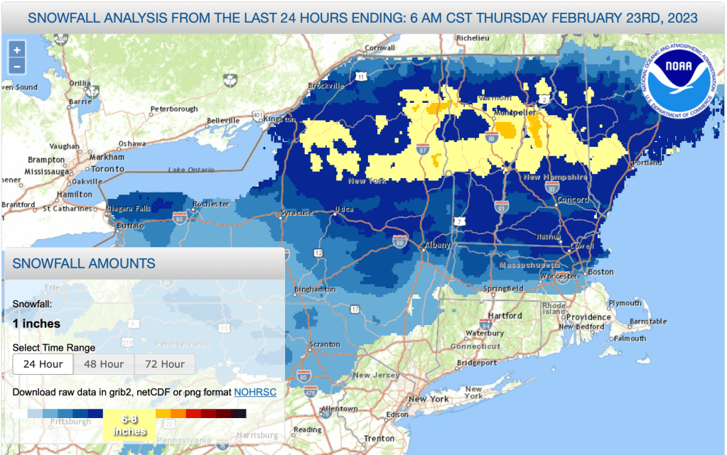
A relatively narrow band of 6-8″ of snowfall runs from the Tug Hill across to the White Mountains. A broader area of 4-6″ of snow fell from the Canadian border south to around southern Vermont and New Hampshire.
This post is about conditions for Feb. 23. 2023, and forecast for the upcoming weeke4nd. See jump links to Conditions and Forecast.
Conditions
Skiing has been revived with the added snow. Oddly though, this storm finished off with freezing rain in the early morning hours, despite temperatures well below freezing. So there is a bit of crust on the snow that skiers will break through if the groomers haven’t gotten to it. Nonetheless, where conditions had been ‘Marginally skiable’ before, they are mostly now ‘skiable’. Touring centers in the area of greatest accumulation have ‘Good skiing’ in the offing for the weekend.
BETA report post for 2/23 has an almost identical title as this post, stating that 6-10″ of new snow has fallen in the High Peaks, and DEC has issued an avalanche warning because the new snow rests on a base of ice or crust.
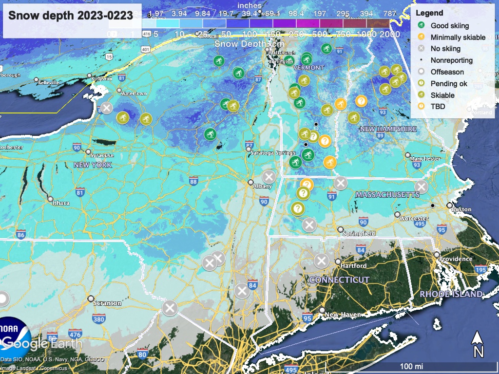
Hit up ‘State of the touring centers‘ or in the menu above for reported conditions as of today. Snow depth graphic below:
Forecast
Cold temperatures and windy on Friday. In the far north, the Adirondacks, NEK, and the tip of New Hampshire will reach the low- to mid- teens. NYC and coastal southern New England will be in the low 40s. Scattered snow or even freezing rain possible. Snow showers could continue across the north country during the weekend.
On Saturday, the temperature gradient across the region will lessen, meaning southern regions will be a bit cooler while the far north will be a bit warmer. Then a gradual warming trend begins on Sunday, and highs will get to the mid-40s downstate and along the coast, and mid-20s to low 30s in the far north. Each day through Thursday, high temps will be a degree or two above the previous day.
A potentially large storm is brewing for early next week, when significant low pressure system arrives from the Great Lakes on Monday or Tuesday. This system could bring significant snow across the northeast as far south as the mid-Hudson valley. Some of the precipitation will become mixed during the day Tuesday. Amounts and type are hard to say, but Minnewaska and High Point could get a few inches of snow..
Following the system of the early week, a second smaller system could bring more precipitation in the latter half of the week. This is too far away and unformed for any predictions right now.

