
In the NYC region we’ve yet to see a real ‘winter’ so far this winter, but a small piece of it might visit the Adirondacks, Green, and White Mountains later this week.
This post is about conditions for Feb. 20, 2023, and a forecast for the coming week. See jump links to Conditions and Forecast.
Conditions
Weekly warm spells in the Northeast make for easy if uninteresting reporting on conditions. Tending a diminishing snowpack, groomers and skiers have to work with frozen or frozen granular conditions in the morning, and loose granular or wet granular in the afternoon. Mid-mornings generally make for better if thrilling, skiing.
Supporting well-groomed trails for skating in such conditions calls for heavier equipment than a snowmachine or four-wheel ATV towing a sled. Investments must be made in specialty equipment for breaking up the ice, pulled by a heavier tractor such as a Pisten Bully. It can be expensive to support a low-impact sport.
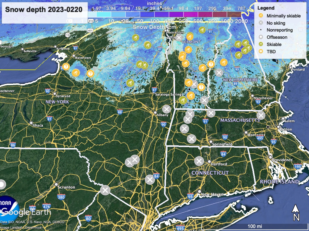
Hit up ‘State of the touring centers‘ or in the menu above for reported conditions as of today. Snow depth graphic below:
Forecast
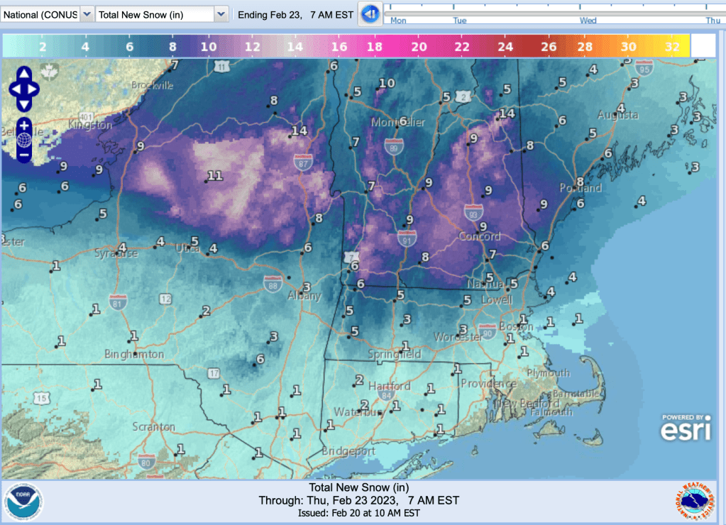
Putting the bad news out of the way- despite a storm coming our way by Thursday, it doesn’t look good for nordic skiing downstate or within 3 hours’ drive of NYC during the next wek.
The good news for the week is that there’s an 80% chance that northern NY, VT, and NH will get more than 4″ of snow, and the National Weather Service predicts much greater accumulation possible in the Adirondack High Peaks, mid- to northern Green Mountains, and the White Mountains.
Quit of the week goes to Woodstock Inn Nordic Center: “Our ribbon of snow is holding on”. So winter stays alive for another week. A bit thin in spots, but still with us.
