Minnewaska has held off on grooming as of Thursday, due to rain and thinning snow cover. Forecast looks promising for a solid refresh at higher elevations heading into the weekend. Magic eight-ball says: ‘hope for the best’.
Downstate area is likely to find Minnewaska and Mohonk the closest with good skiing, but don’t overlook the Berkshires, which is getting a major dump.
This post contains section links to Conditions and Forecast.
Conditions
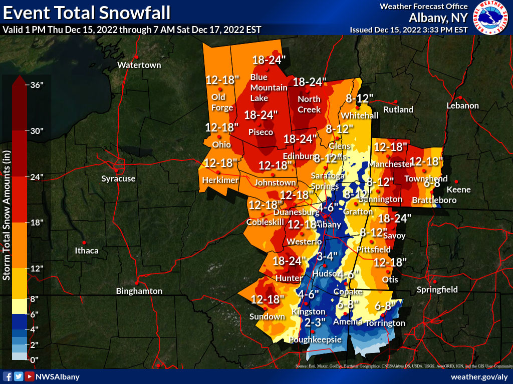
Many touring centers and trails in the bullseye for the storm are closed while the storm is on, and will take an overnight or a morning at least to clear parking lots and groom trails. There could be accumulations of well over a foot today and tonight, possibly two for the entire storm The skiing will be great in central NY state, the Green and White Mountains once things have settled down a bit.
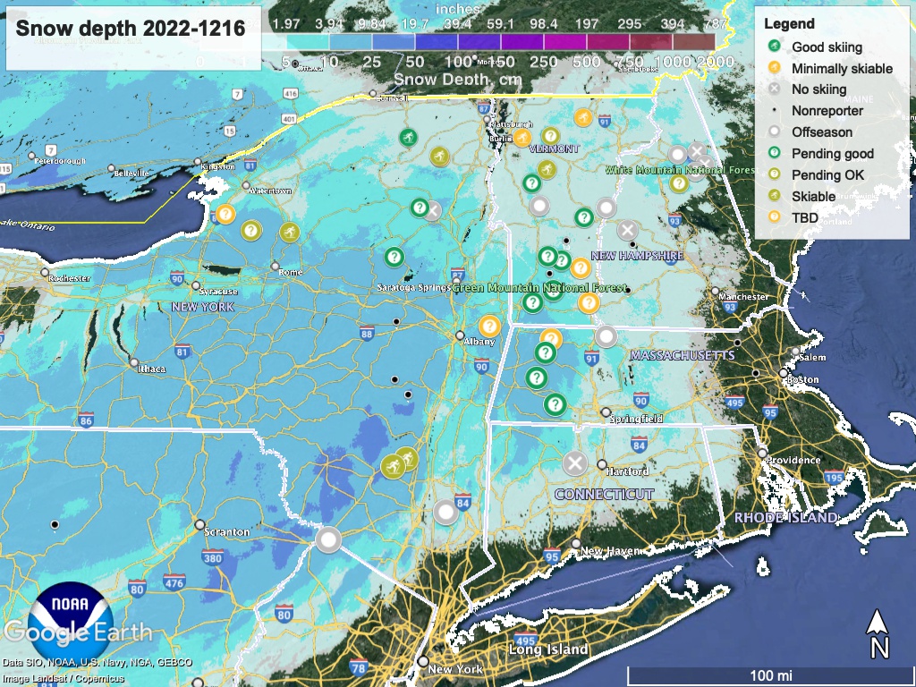
Hit up ‘State of the touring centers‘ or in the menu above for reported conditions as of today. Snow depth graphic below:
Forecast
A low has been moving up the Atlantic coast to south of Long Island on Thursday, and northeast into the North Atlantic past the coast of New England on Friday. Meanwhile mosst air comes in from the West Southwest creating rain in the NYC area, but snow further up north.
Temperatures for the weekend will be mild for the downstate and coastal area, getting into the 40s. But just inland the highs will be just above freezing in many places. These mild daytime temps will continue through Sunday
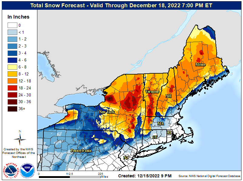
Accumulations could be very significant from the Catskills to southern Adirondacks, Berkshires, and southern Green Mountains. Total snowfall is expected to lessen further north.