
Will we get another shot of winter or are we done? This post contains section links to Conditions and Forecast.
Summary
Hate to be thinking we’re approaching the end of the season this early in March. Chance of snow on late Friday or Saturday, but also strong winds.
Generally mild weather for the midweek; good for late-morning or afternoon spring skiing where cover and trail is available; fast conditions in the mornings unless well-groomed.
Conditions

Unless we get another decent snowstorm, this could be it for Prospect Mountain, Notchview, and some areas in the Green Mountains. The Adirondacks and Tug Hill still have decent cover and could last another week if the weather holds out. BETA report as of 3/6 says: “Wednesday – Friday will be good sugaring weather with daytime highs above freezing and nighttime temps below freezing. This will make for hard and fast surfaces for skiing most of each day”
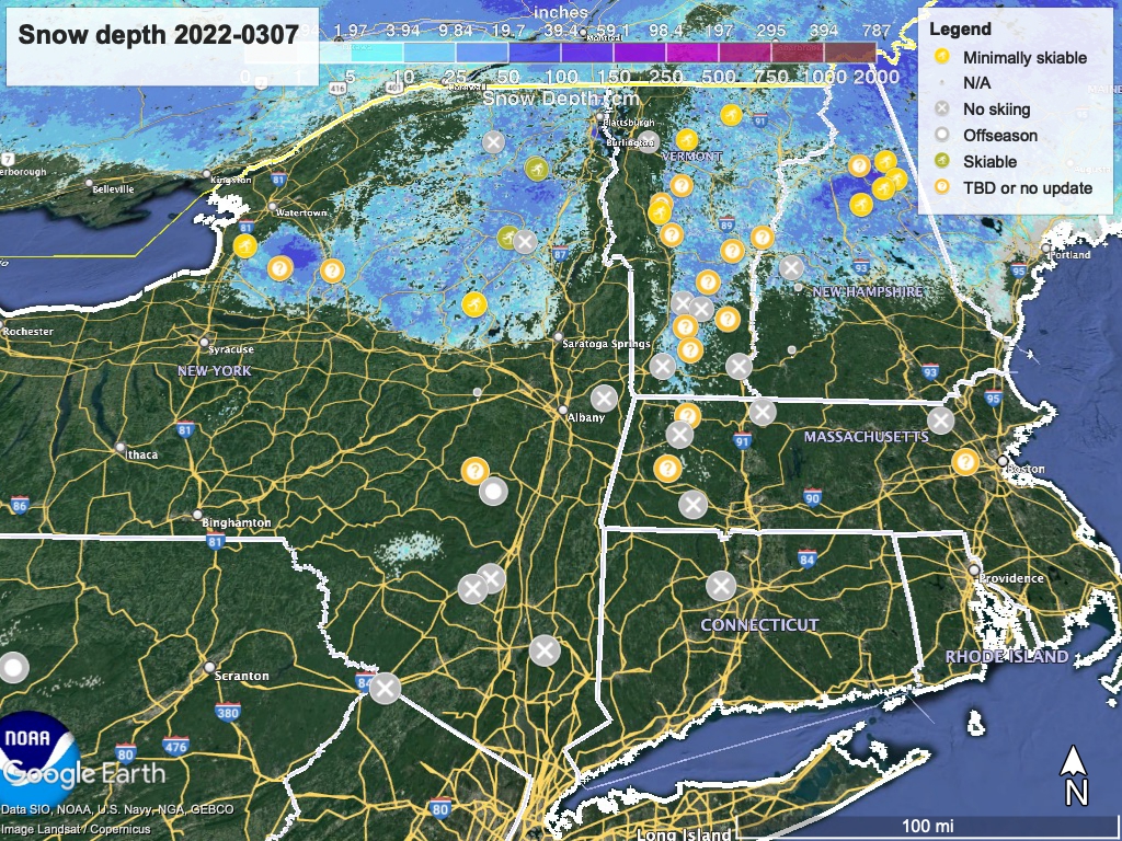
Hit up ‘State of the touring centers‘ or in the menu above for reported conditions as of today. Snow depth graphic below. The depth and breadth of snow cover is in a worrisome state for skiers.
Forecast
Monday: rain, changing at night to snow in upstate New York and in the Green Mountains of Vermont, before ending on Tuesday. Very springlike temperatures, with highs in NYC reaching 70, upper-50s in the Hudson Valley, and low- to mid-40s in the north.
Much cooler on Tuesday, with the downstate New York region reaching the upper-40s, 30s to 40s in the Hudson Valley, and upper-20s to low-30s in the northern areas.
Downstate will stay about the same on Wednesday, upstate and northern regions get warmer, to the mid-40s up the Hudson Valley, and upper-30s to low-40s in the Adirondacks and northern New England. Thursday’s high temps will be a bit warmer overall. Slight to moderate chances of rain in southern New York and southern New England on Wednesday and Thursday.
The warming trend continues on Friday, with high temps in the NYC metro on the low-50s. Upstate and northern regions will be in the mid-40s, with a few mountain areas still in the 20s or 30s. From Friday afternoon onward there’s a moderate chance of rain and rain showers across the northeast. Isolated patches of snow could fall on the mountains of far northern New York and Vermont.
A strong low pressure zone over western New York forms late Friday, resulting in the usual ‘cyclonic’ counterclockwise wind pattern. This one is likely going to track along the northernmost region of New York and New England. As the center moves eastward over the weekend, moisture will be drawn up from the south. This could result in strong winds across parts of the northeast.
Cooling temperatures on Saturday could change precipitation to a wintry mix for northern and central New York State. High temps in the northern areas will range from the mid-30s to low-40s, while NYC and coastal areas reach about the same highs as Friday. Depending on the track of the low pressure zone, northern parts of the region and areas of higher elevation could get some snow, and by Saturday evening snow showers are possible across the northeast. Any snow will gradually cease, with some lingering lake effect snow in central and western New York.
The 6-10 day forecast calls for normal temps and precipitation, but the 8-14 day leans toward things being a bit warmer than normal.
