
This post contains section links to Conditions and Forecast.
Summary
Storm arriving for the weekend could bring significant snowfall downstate; just be careful on the roads as blustery conditions are predicted for late Friday and Saturday. Depending on the amount of snowfall, Sunday could be a great day for enjoying some fresh snow at a local park and an opportunity for backcountry skiers.
Greatest amount of new of snow at the end of the weekend will probably be in southern New England.
Conditions
Fahnestock hasn’t posted an update in a couple of days, a possible indicator that trails are closed to XC skiing. Conditions are so good in places where snow cover is reasonable there’s not much need to update. High Point, Minnewaska, and Mohonk continue to have good conditions. Further north, light dustings of snow and continued cold weather have made conditions pretty spectacular.
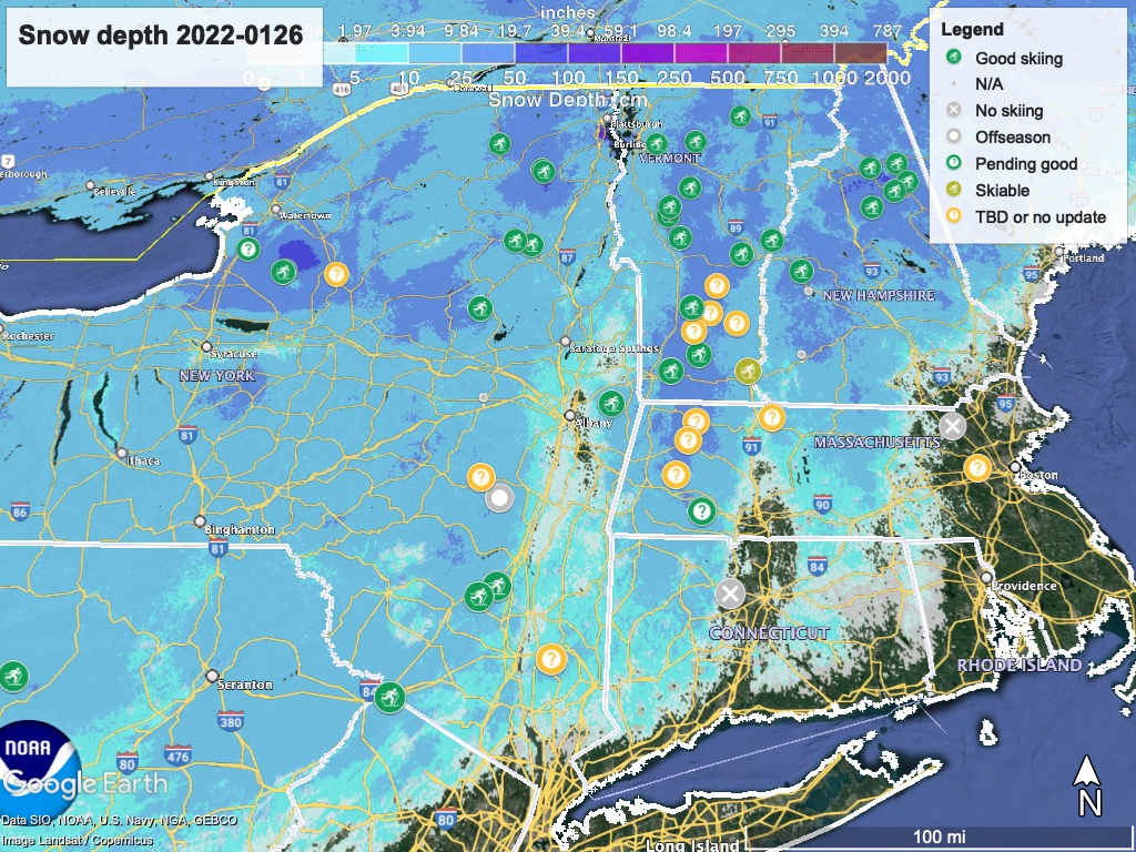
Hit up ‘State of the touring centers‘ or in the menu above for reported conditions as of today. Areas that are part of The Trustees of the Reservations are all ‘?’ and TBD because the Trustees website is down. Snow depth graphic below:
Forecast
A nor’easter with possible ‘bomb cyclone’ atmospheric air pressure differential arrives along coastal areas of the northeast on Friday. This system will likely generate significant snowfall in the NYC area, with increasing amounts eastward along the coast and Long Island. How much snow remains uncertain.
Cold air will arrive in New York State from the northwest starting Thursday night. There will likely be lake effect snow and possible snow showers across interior portions of the northeast overnight Thursday and into Friday. This cold air will meet up with the low that is moving up from the southeast on Friday, setting up the snowfall event.
The greatest effects will be felt in coastal areas, and snowfall inland will depend on the where the the two systems meet. Depending on the track of the low, the downstate could get wintery mix and inland just a bit of snow; or the coast will get only snow and snowfall could reach further inland . Either way, we can expect wind and some snow for Friday night and Saturday. The storm moves on toward Boston Saturday, where snow and storm surges are expected.
Sunday weather will be dry and temps will continue to be below freezing in the NYC metro region. The north country will be in the teens.
The early part of next week will trend dry and warmer, with temps downstate ramping up to the low 30s on Monday and the mid- to high-30s on Tuesday. The north country will go to the 20s Monday and 20s to low-30s on Tuesday. Wednesday’s high temps could be warmer still, continuing the trend to at least the middle of next week
