
[updated Saturday Jan. 15]
This post contains sections and links to Summary and Forecast
Summary
Significant amounts of snow will fall somewhere in the northeast starting Sunday night- it’s just not possible to pin down the amounts; and the only other thing we can say for sure is that any snow we get in the coastal areas early Sunday evening will get rained on by Monday morning.
Be careful if you have to drive Sunday evening or Monday morning. Possible heavy snow and changing precipitation types, as well as gusty winds.
Saturday update:
As shown by the light blue and orange regions in the graphic below, the chances for greater than 8″ accumulation in the Tug Hill, northern Adirondacks, and White Mountains of New Hampshire are quite good. It’s 50-50 whether the Catskills and southern Green Mountains will get that much, but even 4″ would help a lot.
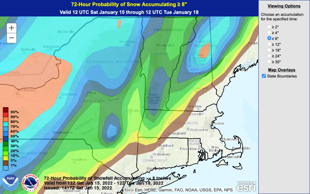
Projected snowfall amounts for Sunday night through Monday below. The range of total snowfall could be anywhere from half of the predicted amount to 50% more. These projections do not account for melt-off from rain or warm weather. Slight changes in course of the low-pressure system will make a large difference in the amount of snow vs. rain in any given area.

Forecast
Daytime temps for Saturday will be cold up north- barely cracking zero degrees F in many places. Wind chill factors will be severe in parts. In the NYC area, about 20˚F, with winds of 20mph and gusts of 30+mph.
Sunday will be much more temperate- teens up north, 20s in the mid- and upper- Hudson Valley, and high 30s along the coast.

The weather to watch for
A coastal weather system will approach the NYC metro region Sunday afternoon. By sometime in late afternoon or early evening, the downstate region could get some snow; however, winds from the ESE will likely change it over to rain. Elevated areas off the mid-Hudson valley, particularly to the west, could see several inches of snow (Hope you get lucky, Minnewaska and High Point).
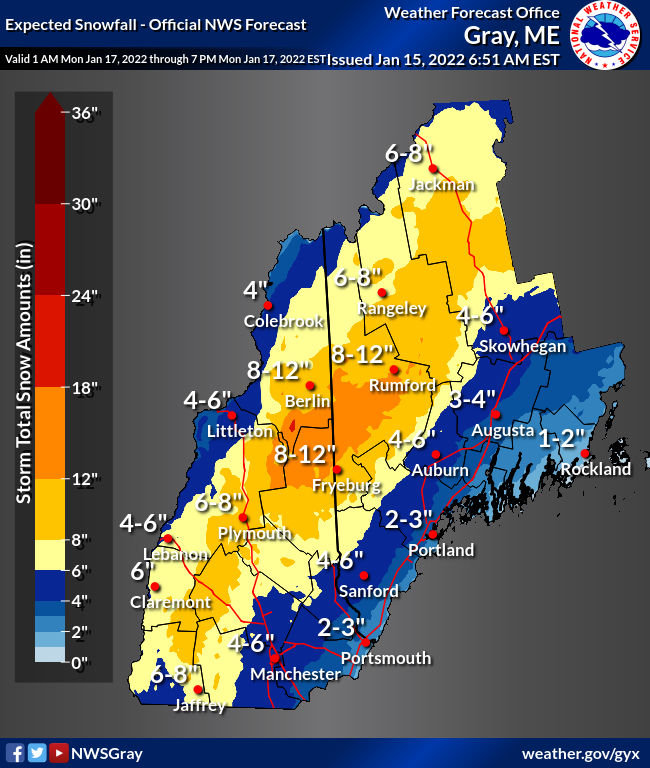
While some lower terrain areas will only see a few inches, high terrain areas should easily see 6 to 12 inches, so a Winter Storm Watch has been issued for the Adirondacks, Helderbergs, Catskills, southern Greens and Berkshires.
Forecast discussion, National Weather Service Albany NY, Fri Jan 14 2022
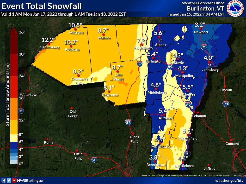
By Monday… greatest snowfall amounts are expected to be concentrated along the eastern slopes of the Green Mountains and the eastern Adirondacks, as well as the Saint Lawrence Valley in New York… while lesser amounts within the Champlain Valley and across the Northeast Kingdom. At this time, possible snowfall amounts range from 8 to 12 inches across northern New York and portions of south- central Vermont, while ranging from 5 to 8 inches across the Champlain Valley and northern Vermont.
Forecast discussion, National Weather Service Burlington VT, Fri Jan 14 2022
The weather system will be picking up moisture from the Atlantic and dropping it as snow when the air rises over elevated terrain such as a mountain. Exact accumulation amounts are hard to predict even now, but expect more snow and less rain/sleet further north and to the west, away from the coast. The system will be accompanied by strong gusty winds in some areas.
Monday will probably be the warmest day of the week, with highs downstate in the 40s, and 20s to low-30s up north. The remnants of the system are expected to clear the region around midday.
Nice time to be freelance or retired
Weather during the week will generally be dry except for a ‘clipper system’ that will come in on Wednesday with slight chances of snow, mainly for the northerly areas. Temps through to the end of the week will trend cooler.

Waiting for fresh snow…
