
This post contains section links to Conditions and Forecast.
Summary
Great skiing today but warmer weather coming, with some chance of precipitation Thursday and Friday. Cooler temps and nice weather for the weekend. How much good the late-week cooling trend does for the remaining snowpack is yet to be determined.
Magic 8-ball says: downstaters keep your fingers crossed for another weekend of skiing.

Conditions
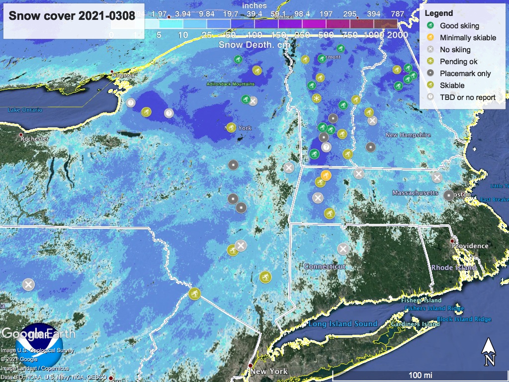
Starting in the mornings, conditions are good in the downstate area, and ‘fast and firm’ in the colder northern climes. Trails will soften significantly during the day, creating some suction on ski bases. We’ll see more wetness earlier in the mornings as the temperatures rise through this week.
While the snowpack depth and coverage are still great (see snow depth graphic below), nights that stay above freezing will mean my next check (probably Friday) is likely to show lots of bare sections.
BETA report from 3/6 says ‘wait and see’ for next weekend. Hit up ‘State of the touring centers‘ or in the menu above for reported conditions.
Forecast
Temperatures throughout the northeastern US will ramp up rapidly to late spring-like weather, reaching highs for the week on Thursday. On that day the NYC metro, the mid-Hudson valley, and eastern Massachusetts could get to the mid-60s. Even northern NY and New England will have highs in the upper-40s to mid-50s, and mid-30s at elevation.
Skies will be clear early in the week. Moderate chance of precipitation late Thursday into Friday, primarily for NY and PA. Precipitation moves out for the weekend, and skies will turn partly cloudy. Winds will generally be light except for the Thursday-Friday period when stronger breezes and some gustiness will come in with the arriving low.
Overnight lows will be above freezing for downstate starting Tuesday, and by Wednesday night even the far northern low-lying areas will have low temps in the 40s. Cooling late in the week will bring lows back down but still above freezing until at least Saturday night.
A cold front from the north and west comes in late Friday. The weekend should start with high temps in the mid-40s to low-50s for downstate NY and southern New England, low-30s to low-40s in the north country with some mountain areas in the 20s or even teens. The cooling trend continues into Sunday with daytime highs about five degrees lower than Saturday.
A low forming to the south of NYC could affect the downstate and Hudson Valley area on Sunday, but forecasts are not yet clear on this. However there is increased chance of precipitation for Monday-Tuesday of next week.
Thanks for reading.
