
This post contains section links to Conditions and Forecast.
Summary
Now it feels like a Northeast US winter. After rain and sleet all across the northeast on Monday, it all refroze on Tuesday. Tracks are fast and loose snow is like sugar.
Just in time for the weekend, a nice refresh is due for us in the downstate region and western MA on Thursday and Friday. Worst day to be on the road: Friday morning, when roads could have a mix of different kinds of precipitation including snow, ice, and rain.
Conditions
As a result of warm temps and the type of precipitation, the snowpack is granular and frozen granular. The storm coming Thursday and Friday should change things for the better, and the higher accumulations will be in the tristate area of downstate NY/northern NJ/northeastern PA, and southern New England.
On Monday the Adirondacks got several inches of sleety snow-like stuff which touring centers have been able to groom easily. BETA report confirms avalanche conditions in the backcountry.
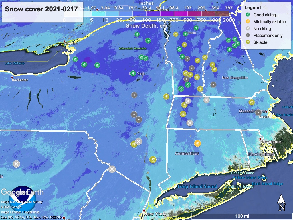
Reporting on conditions in the evening is like serving last week’s fish, but this is mainly for the seasonal dataset. Hit up ‘State of the touring centers‘ or in the menu above for reported conditions. Snow depth graphic is below, as usual.
Forecast
From Wednesday thru Friday, temperatures will ramp up slightly. Today, high temps in the teens to 20s in the north country, and some single digits in the mountains; upper-20s to mid-30s across the downstate NY and mid-Hudson area, as well as southern New England. By Friday the daytime temps in the north country will be in the upper-teens to upper-20s. Downstate and southern New England will be in the 30s.
A series of small fronts form starting on Thursday as multiple branches of a low system come up along the coast and interact with the cold air inland. While much of the northeast will only see snow, we in downstate NY and coastal New England are likely to see alternating forms of precipitation through Thursday night and Friday. Total snowfall is projected to be a few inches up in the far north, and 4-10″ across central NY, the southern tier, and the Hudson valley.

The better news is that temperatures will cool off for Saturday as the winds shift northwesterly and the precipitation leaves. In the far north and inland areas, high temps in the teens to mid-20s; downstate, valleys, and southern New England states will range from the upper-20s to mid-30s. Sunday temperatures remain similar to Saturday, but wind direction will be more mixed, portending another storm arriving late Sunday.
Next Monday and Tuesday will turn warmer, resulting in some mix of rain, sleet, and some snow across most of the northeast. Temps on Monday will be in the 30s everywhere up north except the mountains, which will be in the mid-20s. South of the Catskills and across coastal New England the high temps will be in the mid-30s to low-40s.
