
This post contains section links to Conditions and Forecast.
Summary
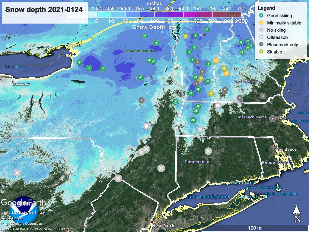
Weather remains just cool enough in the downstate to hold snow during the week. A weather system coming in Monday afternoon promises snow to the west and northwest of the NYC region. Along the coast and up the Hudson, we are due for a bit of snow along with the usual wintry mix and some coastal rain.
High Point location and elevation looks get lucky- let’s hope! Minnewaska/Mohonk? Keep your fingers crossed that a bit of elevation makes all the difference.
Conditions
In general, snow conditions will remain pretty good, degrading as usual with a bit of freeze/thaw. Backcountry conditions should remain pretty good through the week.
Hit up ‘State of the touring centers‘ or in the menu above for reported conditions Jan. 24, except where noted in the details.
Forecast
On Monday evening, a front approaches the region from the southwest. By Wednesday snow accumulation of 2-4″ is likely in northwestern Pennsylvania, the southern Tier of NY, and Finger Lakes region. We in the downstate and mid-Hudson may see some snow, but we will also probably get some wintry mix, with rain in the coastal region before the front moves through.
If the times were normal I’d be saying the Tuesday commute could get slow due to snow in the morning and snow/ice in the evening. To those who do have to commute to work, stay safe out there on the drive or ride.
Through the week and into the weekend, daytime temps will flip day-to-day between being in a range of the mid- to upper 30s or low- to mid-30s in the downstate and Hudson valley. Upstate and north country will be more like teens to mid-20s, but colder on Friday, single digits to teens.
Partly to mostly cloudy conditions will persist through the week, limiting degradation of snow due to sun. Starting Monday a cyclonic system builds over central NY and northeastern PA. By Thursday winds shift northerly, with speeds of 10-20+ mph on Friday. Wind speeds settle down on Saturday, with directions mixed but primarily westerly.
Long-range weather in the 8-14 day period looks to be warmer and wetter than normal. Get out and have fun!
Thanks for reading.
