
Summary: If you can get out skiing between now and Friday afternoon, do it! We don’t see snow close by, but just beyond the Hudson valley, places within a few hours drive have great conditions. Weather uncertainties make it hard to predict what cover will remain after warm weather and rain arrives this weekend.
Canterbury Farm, Notchview, and Prospect Mountain are within easy range for a 36-hour getaway. And if you pack a weekend bag and leave now, you can be having dinner in Garnet Hill, ski all day Thursday and return Friday. Leave the work for the weekend, when it’ll be raining anyway.
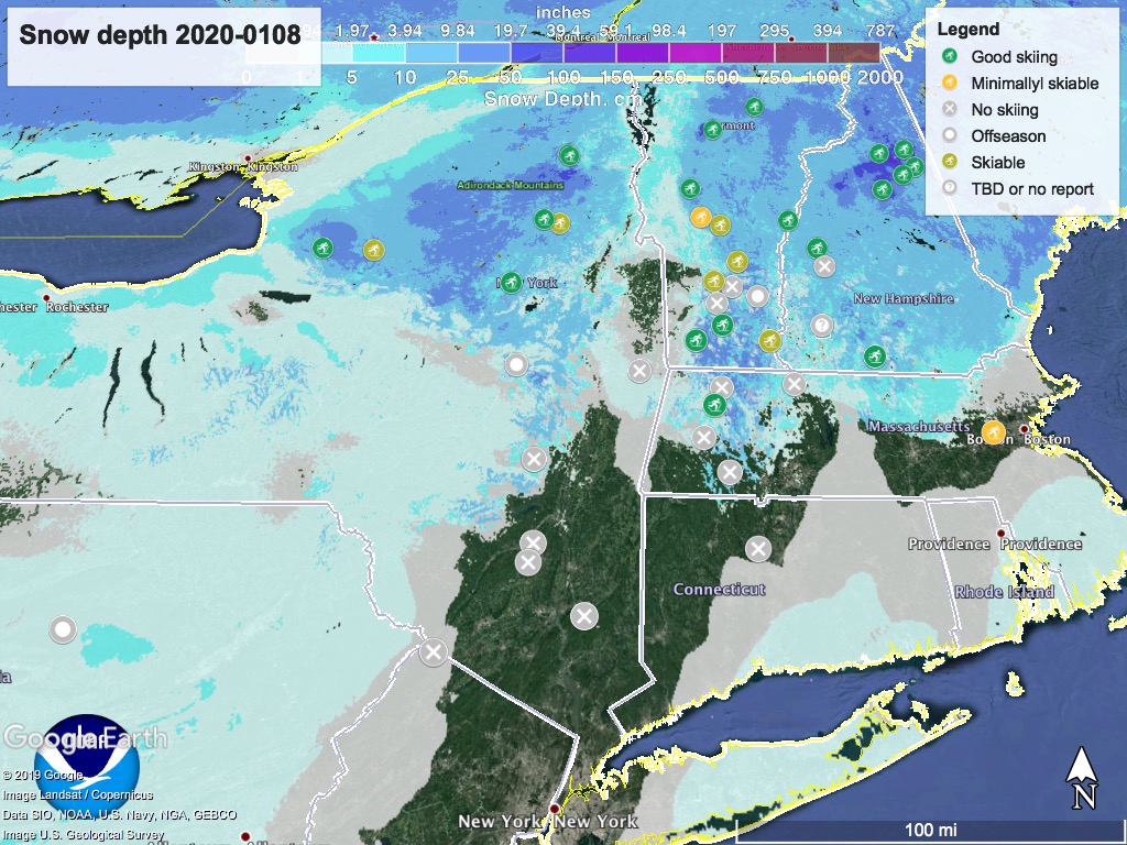
Further north, conditions in the White Mountains seem excellent. And the BETA report from 1/5/20 on Adirondack backcountry says: “While most areas only received the 3″ of the predicted 3-5″, skiing is now quite good in many areas. Generally cold temperatures are predicted for [the] week with additional chances for additional light snow. So get out and ski if you can.”
Listen to mom-

Hit the link to ‘State of the touring centers’ for details. Here’s the current visual of snow depth:
Forecast: In the north country (north of Albany and the MA-VT/NH border), light snow continues Wednesday. Greatest accumulations expected in central NY and the mountain regions of NY, VT, and NH. Thursday will be coldish and sunny, but temperatures will actually start rising Thursday night. A chance of some snow or wintry mix very early Friday, but precipitation will transition to plain rain.
Saturday will be rainy throughout the northeast as daytime temps zoom up to about 60 in the NYC metro area, and in the 40s even in the northernmost areas. This will put a damper (An intentional pun, because what else am I going to do?) on many people’s hopes for skiing that day.
Slightly better news late in the day Saturday as cooler weather arrives from the west, and precipitation may turn over to freezing rain, sleet, or even snow. The changeover is likeliest in the Tug Hill area, the Adirondack High Peaks, northern VT, the White Mountains of NH, and basically all of Maine. Icing on roads in the Adirondacks and northern New England will make driving treacherous Sunday.
Sunday will still be a bummer for many, despite the cooler temperatures. After the expected rain Saturday, cover is likely to be nonexistent or just too wet to ski on.
North country weather predictions for Sunday are up in the air (another intentional pun), depending on the way the cool front intersects with remaining wet weather. There might be a sudden and significant (by which I mean several inches to a foot) accumulation of snow and sleet in isolated areas. If so, hopes for skiing will rebound, made more urgent by the prospect of additional rain/snow/ice in the late evening Monday and into Tuesday.
Thanks for reading. Carpe diem.
