
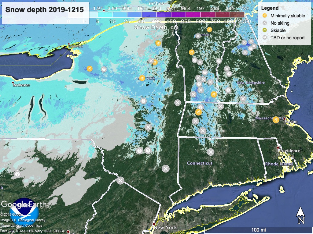
But hey- it’s just mid-December. Plenty of time to have a great season. ‘State of the touring centers’ is not pretty, but it is what it is. Here’s the graphic view:
Forecast: Starting Monday, a front enters our region, bringing rain, some snow and the dreaded wintry mix into the overnight and Tuesday, before moving out in the early hours of Wednesday. A few inches or more of snow could fall in the northern Catskills and southern Adirondacks, Berkshires, Green and White mountains.
The immediate NYC metro region is likely to get a mostly sleet, a bit of ice, and some rain, which will potentially add to Monday evening or Tuesday morning commute joy. Driving in the mid-Hudson valley region on Tuesday could be hazardous due to ice.
Ski touring areas could get snow or sleet (or rain), but there’s not much point trying to predict the outcome. Currently our friendly National Weather Service predicts Fahnestock and High Point are not likely to see much accumulation of snow amidst freezing rain and wintry mix. Minnewaska could get as much as a couple of inches of snow. Prospect Mountain will probably see some usable snowfall from this one.
Temperatures remain cool enough during the rest of the week to help hold onto whatever snow is received. Looks like lake effect snow will drop on Tug Hill plateau and central New York.
A front looks to be coming from the south up the coast, reaching the region on Saturday.
