Summary: get out skiing now, because you have your pick of spots to ski at, all the way from New Jersey to the Pioneer Valley and Vermont. Areas that got a big dump (more than 12″) and are just a bit higher in elevation or a bit northward of the city are likely to keep some good cover through the weekend.
The clock on the season has now started for a number of nearby ski centers. The snow cover depth maps so well to the locations of touring centers, you’d think they were sited there on purpose…
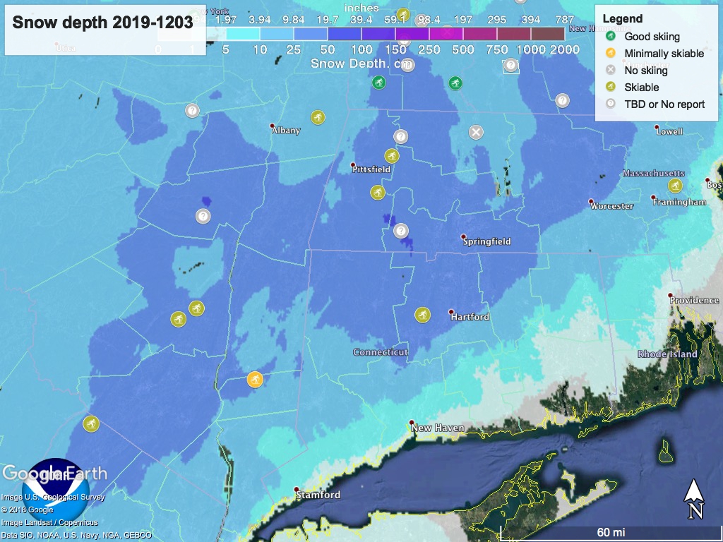
This storm brought snow that is relatively dense and laden with moisture, making it slow going if you’re breaking trail. Touring centers are rolling and packing today, and conditions will hopefully be faster and smoother once they finish and set tracks. Some other areas still haven’t quite gotten ready for the season and are evaluating their trail conditions.
Advise getting to Fahnestock today or tomorrow, because the cover is thin and may not last to the weekend. High Point, Mohonk, and Minnewaska are good options for Thursday or Friday. Prospect Mountain, Notchview, and Lapland Lake would also be great choices, albeit further away.
Daytime temps will go to mid-30’s up north (cooler on mountains), and into the 40’s in the lower Hudson valley tomorrow and Thursday, before cooling down Friday and Saturday. Sunday will turn warm again. Overcast skies on Wednesday and Thursday with prevailing winds from the west could bring some scattered snow showers to the Tug Hill plateau, Adirondacks, Green and White mountains. Some accumulation possible.
If you plan to head farther north, here’s the usual map:
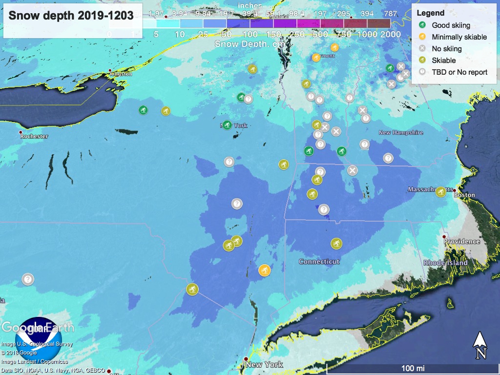
‘State of the touring centers’ is updated, and it’s all pretty good news, especially for this early in the season.
Hang this on your cubicle wall: