
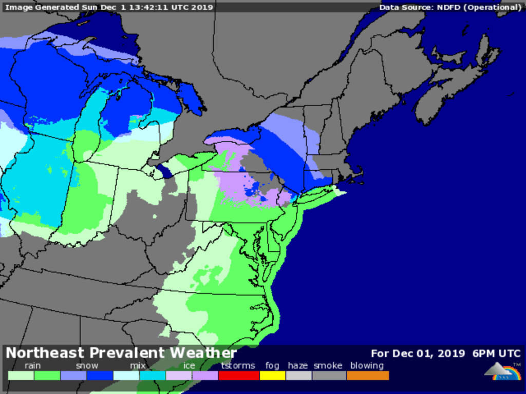
Summary: the NYC metro area probably won’t see more than a few inches of snow total from Sunday through Monday night, but go north and to the interior, and there could be nothing but snow for over a day.
Once again, it’s icemelt for us, and shovels for folks to the north. The Tug Hill plateau will likely get all snow out of this system. Precip over the southern Adirondacks, VT and NH will shift to all snow tonight and continue through Monday. High Point looks likely to get snow all day Monday. Minnewaska and Mohonk could get 9+ inches total from the storm if the snow is intense enough. Fahnestock could get 6+ inches total.
Forecast for NYC metro as of the morning of Dec. 1 gives some sense of how the storm and temps will play out (courtesy of those treasonous weather forecasters at the National Weather Service, who dare to strive for accuracy):
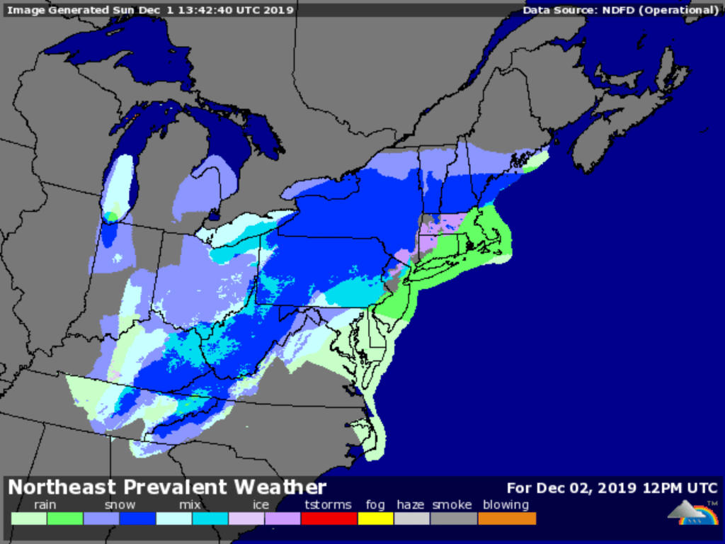
The storm system will have two main stages, pertaining to the accumulating snow. First main stage of snow is this morning into this evening, mainly across the interior. There will be a transition to plain rain at the coast this afternoon into tonight while the interior will transition to a wintry mix. The second stage of snow will be Monday into Monday night. Precip types will change back to pure snow from north to south during the timeframe as colder air works its way into the local region on more northerly flow.
Area Forecast Discussion issued by NWS Upton, NY
NWS Storm Prediction Center has an arsenal of tools to help forecasters wrangle data. Sure beats a sharpie.
Below are some screenshots from Weather Underground. And yes, it’ll be a messy commute Monday, as precipitation could shift from rain to snow even in the city. But the march of the snowline toward the south, plus relatively cool daytime temps through the week could mean skiing within daytrip range for next weekend.

Get that icemelt out of the garage, and grab the shovels too while you’re at it. Thanks for reading.
