Mild days are rendering a firm and hard snowpack into wet granular conditions by late afternoons. Breeze causing debris at some areas. Still some skiing within the long-day-trip range.
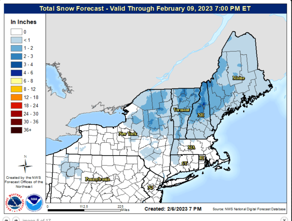
Temperatures through the week will make any precipitation from two minor fronts fall primarily as rain, with the possible exceptions being the farthest reaches of the northeast. Potential snowfall for upstate regions and New England is possible for Friday night into Saturday, but the exact track is yet to be revealed to us
For more info, see jump links to Conditions and Forecast.
Conditions
As with early last week, freeze-thaw cycles make for difficult mornings. Add a diminishing snowpack and there are choices to be made about when to groom. Expect that many areas will prioritize grooming for the weekend.
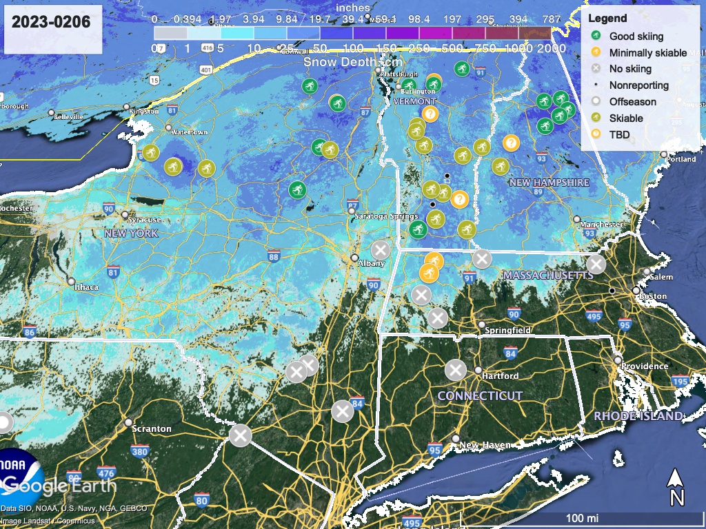
Hit up ‘State of the touring centers‘ or in the menu above for reported conditions as of today. Snow depth graphic below:
Forecast
Two small low-pressure systems come into the northeast Tuesday and Thursday. There’s a chance of some snow, but not much accumulation. With mid temperatures more reminiscent of early spring than mid-winter, the remaining snowpack will become granular and depth will lessen through the week.
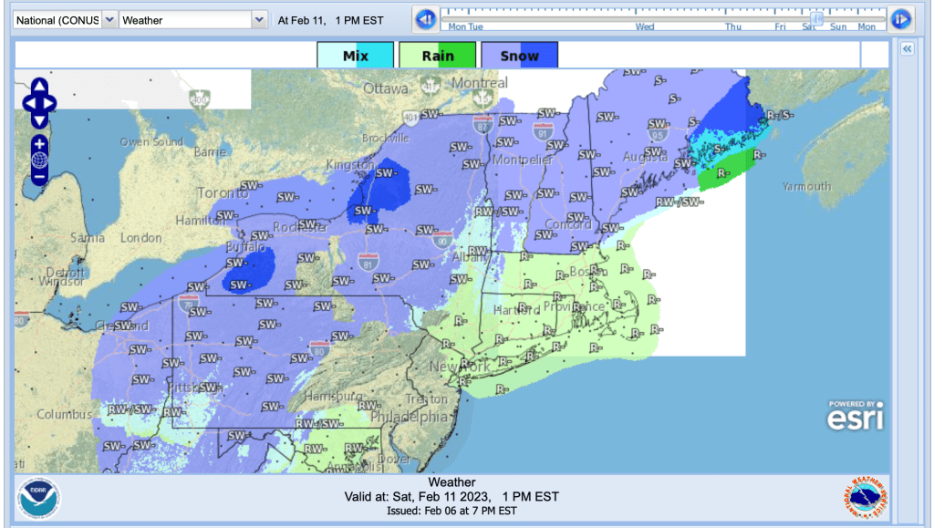
For the weekend, a collision between a large low-pressure system moving from the midwest and a cold high pressure system off the coast could yield snow and wintry mix across much of the northeast on Friday night and into Saturday, but the situation is too unpredictable to predict the rain-snow line or amounts. There’s some hope for a refresh by the end of the day Saturday, for some nice skiing on Sunday.
As with the previous week, the weekend will be cooler than the week, although nothing like the weekend just past. Sunday Feb. 12 expect the high temps to be in the upper 30s to low 40s in downstate NY and the NYC metro, while upstate and northern New England will get to the 20s or low 30s; teens at the higher elevations.