
Heavy snow fell across for the north country areas on Wednesday night and into Thursday, covering them with a wet blanket ranging from 3-8″ thick. This is slightly disappointing compared with the forecast, but combined with snow on Monday, some spots received over two feet of snow for the week!
Unfortunately for central Vermont and the southern Adirondacks on southward, snow in the first part of the evening turned to rain at the end. This resulted in either very wet cover that needs tie to drain, or a crust on top of damp snow. Some areas are continuing the cleanup for today.
Some snow is better than now snow, and the outlook for next week is gradual cooling and a slight chance of snow midweek. So it looks like we’ll be able to keep XC skiing around within a 3-1/2 hour drive. Enjoy!
This post contains section links to Conditions and Forecast.
Conditions
Be grateful it didn’t all turn to mush in the end- the folks at BETA report are. They say trail breaking will be a tough go, but they’re happy to have the 4″ or so of new snow regardless. With the weather beginning to cool, the wet snow is draining a bit and forming a crust. Grooming will turn that into a sugary, snow-like substance that sometimes behaves a bit like tiny ball bearings underfoot.
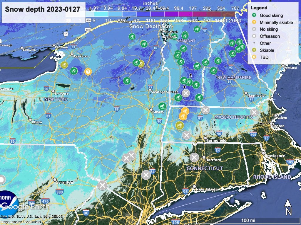
Hit up ‘State of the touring centers‘ or in the menu above for reported conditions as of today. Snow depth graphic below:
Forecast
There’s light snow possible on Sunday for the Tug Hill, Adirondacks, and central-northern Green Mountains.
Following the weekend, the next significant storm system is due to arrive in the region on Wednesday, and may result in scattered snow showers across much of the northeast. The snowfall vs. rainfall line will most likely be north of Albany, as it has been in the past two winters.
Temperatures will max out on Sunday, after which things will cool off and feel quite wintry up north. NYC will see 50 degrees on Sunday, and even some of the northern mountain areas may be above freezing during the day. But by Friday, NYC will be just about freezing, while elevated areas of the Adirondacks, Green, and White Mountains could easily be in the single digits.
