[See below for update]
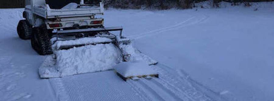
The featured image comes from Viking Nordic Center. This post contains section links to Conditions and Forecast.

Summary
Spring Skiing! This weather is hard on the snowpack, and the warm stretch will continue until Saturday afternoon. For now Prospect Mountain is still pretty good, as is Notchview. Pineridge is also open and a bit closer.
[Update Thursday 2/10]: Minnewaska will have trails open for skiing Friday. Limited terrain, track setting may not be possible. Upper Awosting will be reserved for skiing, while other trails will allow walkers. High Point remains open, with some bare spots. Conditions at both would be classified as ‘minimally skiable’. No telling if things will hold through the weekend,
The drop in temperature on the weekend is going to be a bit shocking. Not much precipitation in the forecast for the next five days. We have to hope some snow comes next week. If you have any ice or puddles to clear, do it before Saturday afternoon.
Conditions
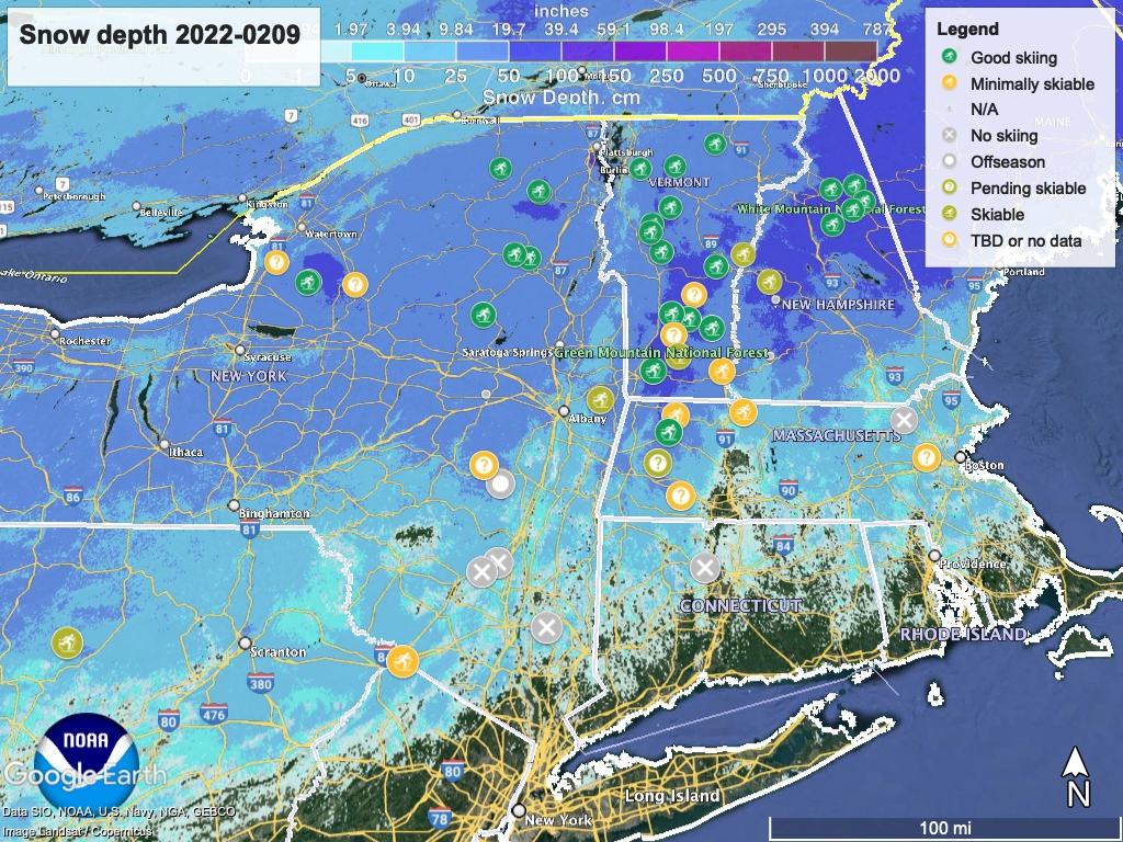
Springlike conditions all the way up through to the north country, and thin base and sporadic grooming at lower elevations. Nighttime freezes make morning skiing more challenging, and trails will soften up in the afternoons.
North of Albany and southern Vermont the trails are a bit better, as the colder temps and greater snow depth give the groomers more to work with. In particular the Tug Hill and the White Mountains got a decent refresh of snow recently.
Hit up ‘State of the touring centers‘ or in the menu above for reported conditions as of today. Snow depth graphic below:
Forecast
It’s going to be warm for the next few days:

Precipitation begins tonight starting from the western part of NY and PA. In the lowlands it will be rain, with some snow showers at higher elevations. During the day Thursday, whatever started as snow showers will mostly change to rain. As winds shift WSW and move the precipitation out in the evening, some of those rain showers will shift back to snow.
On Friday, prevailing winds shift more southerly; western NY and the north country might get a shot of rain or snow. The rest of the northeast has only slight to moderate chance of precipitation. Any precipitation in the northern Adirondacks as well as northern New England should fall as snow, but elsewhere it will be rain.
Saturday is when things start getting interesting for us. During the daytime the entire northeast will be really warm: mid- to upper-50s in the NYC metro area, and upper-30s to mid-40s up north. Later in the day a cold air mass will arrive from Canada and the Great Lakes, and winds will begin shifting more westerly. As that happens we can expect considerable cooling. By the evening winds will be out of the WNW, and whatever precipitation remains will change to mostly snow except along the coast.
The overnight of Saturday-Sunday will feel shatteringly cold after the warmth of the week. The Tug Hill and far northern parts of the northeast will see nighttime temps drop below zero degrees Fahrenheit. Much of the rest of the northern parts will see lows in the teens to low-20s. The southern and coastal parts of the region including NYC will drop below freezing.
Sunday will be winter-like, with temps downstate in the low- to mid-30s, and teens to low-20s up north. Winds will become northwesterly and finally northerly. A system forming along the Gulf coast is expected to arrive near the northeast coast late Sunday into Monday. NWS speculates we won’t get much precipitation from it, but reserves the right to change their prediction if the system moves closer to shore.
The beginning part of next week will be cold, with daytime temps similar to Sunday. Next Monday, westerly winds could bring the Finger Lakes and Tug Hill some light lake effect snow.
