
This post contains section links to Conditions and Forecast.
Summary
Not a good week for skiing. Looking forward, think about skiing on Saturday and maybe early next week. Keep your fingers crossed that you’ll be able to use your ‘rock skis’ somewhere local; otherwise be prepared to take a longer-than-desirable day trip.
Conditions
What can I say- where there’s any cover, it’s pretty thin and icy. Touring centers are now advising ‘advanced skiers only’. BETA report as of 1/3/22 doesn’t sound so great, but things could improve greatly by the weekend.
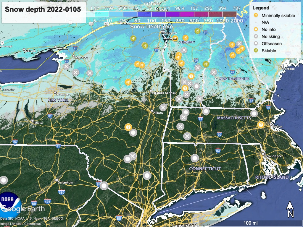
With multiple storms and changes in temperature expected over the next week, conditions are likely to change frequently. Let’s hope we get lucky. Hit up ‘State of the touring centers‘ or in the menu above for reported conditions as of today. Snow depth graphic below:
Forecast
Lake effect snow across the Tug hill and portions of the Adirondacks tonight continuing into Thursday, with light snow possible across the broader region of the Adirondacks to Green Mountains. Some isolated areas of the Tug Hill and northern Adirondacks could see several inches by the end of the Thursday, with continued snow showers across the Finger Lake and Adirondack region on Friday.
Starting Thursday evening, a (currently forecast as mild) winter storm comes into the NYC region from the southwest. This will be primarily a coastal storm. Snowfall expected across a broad area of the northeast, heaviest in southern NY and New England. Accumulation not expected to exceed 4″, and many places will only see an inch or so.
Saturday evening, another small front drops precipitation, starting from western NY and working its way east. This will change variously into rain/wintry mix during Sunday daytime depending on latitude and elevation. Remaining precipitation could then flip again to colder variants of water during nighttime, before petering out Monday. Lake effect snow may continue falling across the Finger Lakes region and portions of the western Catskills and Adirondacks on Monday.
Temperatures over the next week will swing from balmy to wintry a couple of times.
High temps up north today (Wednesday) are in the 30s, while in the NYC metro it’s been the mid-40s. The trend will go downward through the end of the week, and Saturday the highs will be in the teens-20s up north, and in the 30s downstate.
Sunday, our highs will bounce up to the upper-40s in the NYC metro, and the 30s up north, before trending down again for Monday and Tuesday. Tuesday will feel like a real midwinter day, with highs only in the mid-20s in the NYC metro area, and single digits in the far north.
The timing of weather and temperature holds scant hope that any of the downstate areas will get enough snow to open on the weekend. Snow that falls on the weekend may melt some on Sunday, and then become crusty/icy for Monday.
