

Summary
Conditions for weekend of March 20-21 and next week. This post contains section links to Conditions and Forecast.
You’ll have to go further north to find the trails over the next week. So far Lapland Lake is still OK, as are Notchview, and Prospect Mountain. Survey of conditions and expected weather have me speculating that New Hampshirites in the White Mountains have the best shot at skiing through the end of March.
You’ll want to know how to stay centered on your skis and execute a snowplow sharply for the next few days; probably should take the rock skis just in case.
Conditions
The warm spell and some rain earlier in the week left some work for groomers. In the mountains and far north country there’s good cover, but expect the next few mornings to have fast conditions on frozen/lo0se granular. Things will get considerably softer through next week’s warming trend, but that will mean thinning cover as well.
BETA report says backcountry in their area should be decent once surfaces soften up through during the mornings. Hit up ‘State of the touring centers‘ or in the menu above for reported conditions. For a look at our disappearing snowpack, the snow depth graphic has now returned:
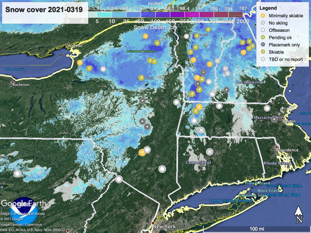
The lonely yellow dot just outside the snow zone is Minnewaska State Park. Although the park has stopped grooming, the Shawangunk Nordic Ski Association is a never-say-die group. ‘It’s still skiable’ as long as they can use rock skis and walk the bare spots.
Forecast
Maple sugaring season is here, as the warm days encourage the sap to flow.
Cold nights through the weekend with warm temps in the daytime. Saturday highs for downstate and low-lying areas will be in the 50s; north country and mountains will be in 30s and 40s. On Sunday the highs pretty much everywhere will be in the 50s, and even the mountains will be in the 40s.
Warm weather continues for the next week. Low-lying areas across the northeast will be in the 50s and 60s during the day; Mountain areas will get to the 40s and 50s. Nighttime temps outside the mountains will creep up above freezing by midweek.
Slight chance of rain possible for NYC and southern New England early next week, and moderate chance of precipitation for the northeast next Wednesday and Thursday.
The 8-14 day outlook indicates slight probability that we’ll see precipitation above normal, and a significant probability that temperatures will be above normal at the end of the month.

Thanks for reading.
