
Summary: The places that have skiing will mostly be able to keep it. Good grooming will allow some places to stay in skiable shape through the weekend. But aside from some light snow in the north country early this week, there’s no major snowstorm in sight.
If you’re able to jump out Wednesday you might be able to get skiable snow at Minnewaska! Shawangunk Nordic Ski Association posted this on Facebook Tuesday afternoon:
Conditions:
I’m grading on the curve this time because a number of places have trails open but a thin base, so there are some limits on grooming or track setting. For now, ‘Good skiing’ means ample open trail whether groomed or not, and no call for ‘rock skis’. The places in NY that seem to be in the best condition are the Osceolas, Paul Smith’s VIC, Lapland Lake, and Garnet Hill. BETA reported some decent trails for light touring as of Jan. 3.
If you’re in VT, then go to Prospect Mountain or Woodstock inn. For NH it’s Waterville Valley. Crystal Lake in PA must be doing well because they’ll be open Wednesday.
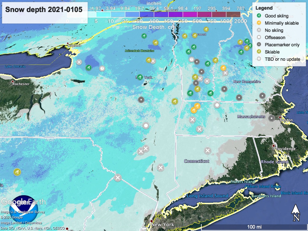
Hit up the menu above for ‘State of the touring centers‘. Snow depth graphic below:
Weather:
Mild winter temperatures across the northeast this week- in the mid-20s in the north, mid-30s to about 40 in the lowlands and NYC area. Winds will be light and north- to northwesterly.
Some light snowfall in the north country and western NY state tonight and through Wednesday, but nothing south of the Catskills or further east than the Hudson/Champlain valleys.
Late next Monday or early Tuesday, winds shift to west- southwesterly and light snow showers may start. These could shift to rain in NYC and the Hudson valley but continue as snow across NY state, VT, and southern New England.
Thanks for reading.
