
Summary: The rain caused many areas to close trails if only to prevent what little snow remained from being skied into ice. There isn’t any real hope for improvement until next weekend at the earliest.
But miracles can happen on Tug Hill with a bit of lake effect snow, and both the Osceola ski areas report skiable conditions.
Conditions
Snowmaking is the word for this season- if you’ve got it, you can manage a marginal skiing capacity despite adverse weather. Mt. van Hoevenberg has 3k open, Craftsbury 2k, Gore mountain has 3 of 12 cross-country trails open, and Rikert and Mountaintop each have about 1k skiable, all because they have snowmaking.
Of the natural snow-dependent areas, Prospect Mountain has altitude and a healthy base, and the two Osceola ski areas have Mother Nature on their side. The OG Osceola has even skate groomed 20k. Of course Fahnestock, Mohonk and Minnewaska trails are washed out. High Point lost most of its snow, so trails are closed.
BETA reports “Very little [snow] left even above 4,000 feet. Temperatures have cooled down, so all that water has turned to ice, making good traction (Microspikes or better) required right from the trailhead.”
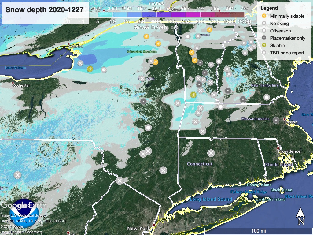
Hit up ‘State of the touring centers‘ or in the menu above. Survey the damage to snow depth in the graphic here:
Weather
A mix of precipitation arrives late Sunday and into Monday as light breezes shift from southerly to westerly. The precipitation will be mainly rain and wintry mix, with some snow in central NY and higher elevations earlier in the day but not much accumulation. Daytime temperatures Monday will range from the upper 30s up north to almost 50 in NYC. Cooler temps on Tuesday will feel a bit more like winter- up north snowmaking could go on all day, and remaining precipitation may fall as lake effect snow in central NY and the Tug Hill plateau.
But- beginning Wednesday temperatures across the northeast will trend upward again. Starting Wednesday evening, some light snow could fall in central NY and the north country, but warmer air coming from the south will change precipitation to rain across the entire region for New Year’s Eve. Nighttime temps will be below freezing, so places that have the budget and water could make snow.
Despite daytime temperatures above freezing for the northeast, a westerly change in wind direction on Friday could change precipitation back to snow briefly for northern NY, VT, and NH. Unfortunately, temperatures don’t look cooperative during the weekend for a return to winter.
