
Summary: We had a great weekend for cross-country skiing, and yesterday was pretty good too. You were wise if you also got out early today (Tuesday). Even though it’s starting to get thin in the downstate region, areas that received enough snow and are just a bit cooler (northwestern NJ, the Hudson Highlands and Catskills) can still have decent trails into tomorrow.
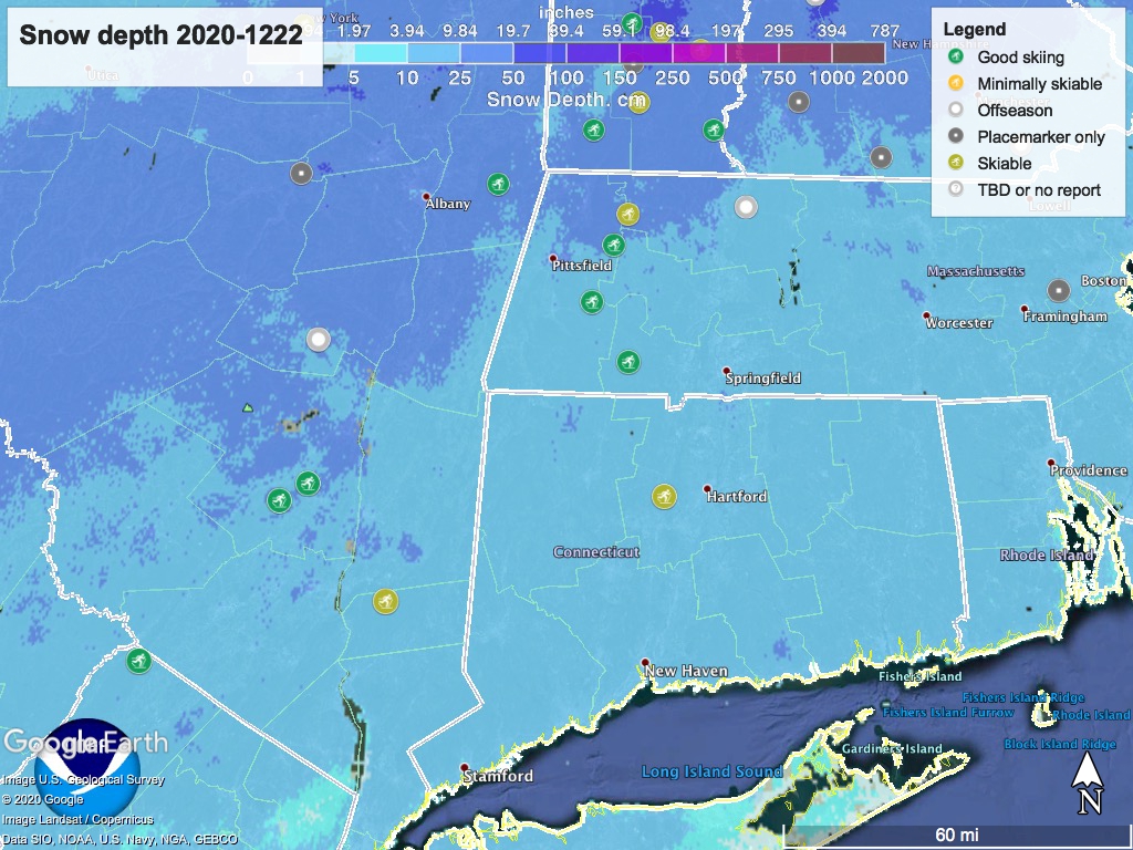
Snow depth graphic below for the area within daytrip distance, and ‘state of the touring centers’ updated.
‘Pause’ button for the end of the week
Potentially heavy rain will arrive across virtually all the northeastern US on Christmas Eve. The amounts forecast plus the warm temperatures from the daytime will almost certainly result in unskiable conditions for Friday. By Saturday afternoon, some touring centers may be able to groom enough to be worth opening. Backcountry conditions could be too thin or icy or both.
Bummer.
Weather forecast:
Possible snow showers Tuesday, mainly in central New York State and the mountain regions of northern NY, VT, and NH. Winds shift southerly in midweek, bringing warmer weather and moisture. Temperatures will be on a rising trend until Friday.
Rain arrives Christmas Eve. In the north country this could start as snow showers. But with high temps for Thursday into the 30s and even 40s even in the north country, this will likely turn to rain. BETA is expecting rain in Lake Placid. In the NYC metro area the daytime temp could reach almost 60 degrees.
The rain moves eastward on Friday, pushed by a cold front arriving from the west. The cold front will change precipitation to snow or snow showers through the course of the day going from west to east. Temperatures will go back below freezing for much of the northeast US for the weekend.
Lake effect snow will fall in central NY State Friday evening, and snow showers may spread across the north country and parts of New England on Saturday and possibly into Sunday morning.
By Monday Dec. 28 we may see light snow showers to north and west of NYC metro area, and light rain showers along the coast.
What can we expect for skiable terrain?
Friday is probably a lost day- where the snowpack survives it will likely be waterlogged after Thursday and need to drain. Regardless, the cold front will make things icy or solid ice, requiring some aggressive trail maintenance to make it comfortable skiing.
The downstate NYC metro area isn’t going to fare well, but it might be worth checking on High Point, Minnewaska, or Pine Ridge on Saturday just in case. Areas further north might fare better, but it’s hard to say right now.
Timing of grooming schedules and snow showers may make Sunday the best day of the weekend, assuming you can drive a few hours to Lapland Lake or the Tug Hill plateau. Monday might be even better, should additional fresh snow cover an icy base.
