
Summary: get out and ski the areas close by while the getting is (very very) good! Despite warmer weather coming, the large amount of snow could hold areas within longer daytrip distance through Christmas Day at least.
Best bets: High Point in New Jersey today (they also have enough cover to possibly have skiable conditions on Christmas); Fahnestock for this weekend; Minnewaska and Mohonk up through the earlier part of next week at least.
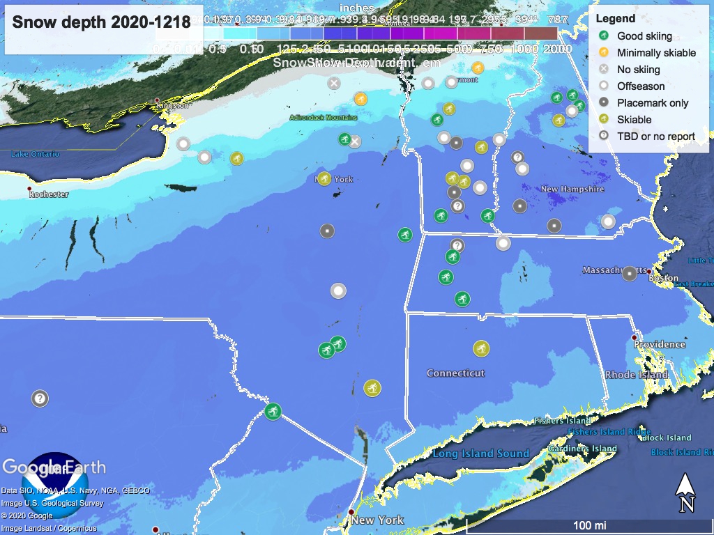
In a turnabout, the latest snow depth with placemap markers by skiing conditions shows the excellent skiing to be had most everywhere except for the Northeast Kingdom and the Tug Hill plateau:
‘State of the touring centers’ has been updated to reflect conditions today and expected for the weekend. For everyone living south of the North Country, this is the weekend we’ve been hoping for.
Holiday week forecast
Starting Sunday, daytime temps will progressively rise above freezing for places within daytrip distance from the NYC metro area, to about 50 degrees in NYC on Christmas Eve.
Clear weather expected until Sunday late afternoon, when possible snow and rain showers may arrive somewhere within a window of time from Sunday night through Monday. Light westerly breezes give respite from precipitation on Tuesday, but more moist weather comes in starting late Wednesday.
From this far out there is no exactness to the weather forecast, but it looks like on Christmas Eve there will be moist air from the south meeting a cold front from the west again. This time around however, the air won’t be cold enough for it to fall as snow except in central and northern New York plus Vermont and New Hampshire.
Thanks for reading, now go out skiing.
