
See it and weep (just a bit). Snow cover is getting pretty thin, so unless the coming storm delivers some real replenishment, there might not be great snow to ring in the New Year with. Here’s the current state of snow depth:
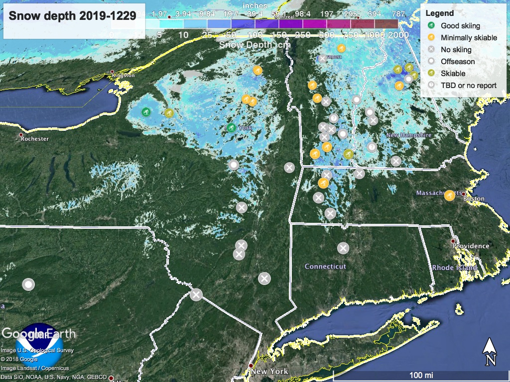
As usual, ‘State of the touring centers’ is updated. It’s what you’d expect given the weather.
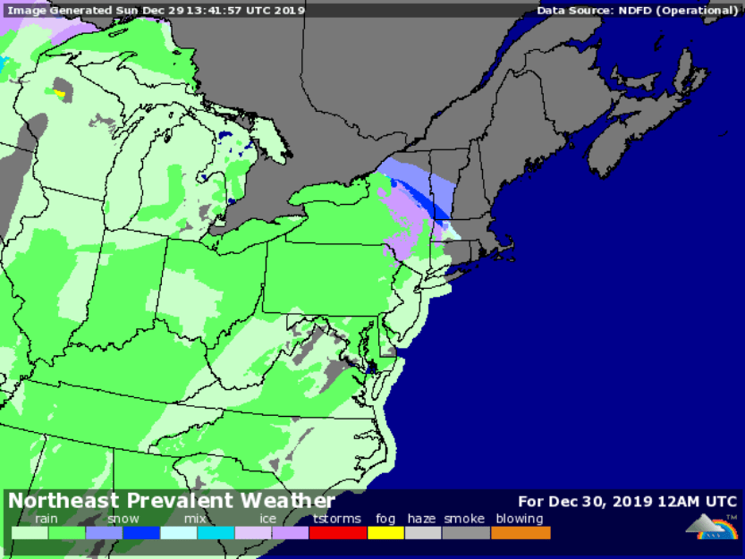
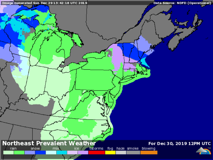
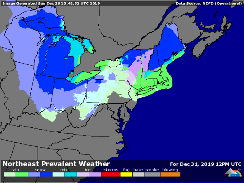
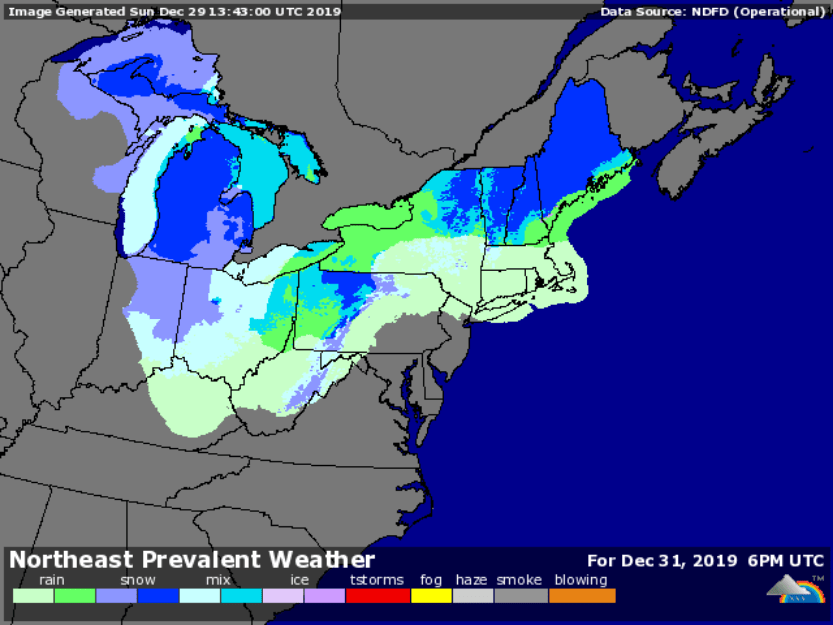
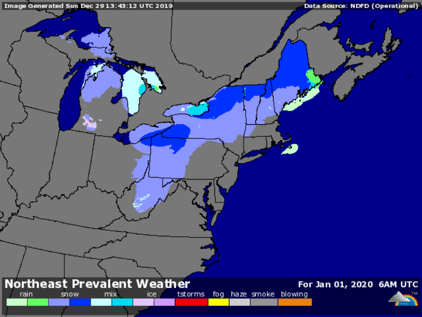
Forecast: A mix of snow, ice and rain across the entire northeast. There will likely be some good snow accumulation in higher elevations of northern NY and New England. If we’re really lucky, the storm might leave a light cover of snow from the southern ‘dacks thru New England during the overnight to the New Year.
Over the next couple of days commuting will be messy and driving in the north country treacherous, so caution advised.
Here’s a gallery of screenshots from Underground:


Thanks for reading.
