
Welcome to the first week of 2026! Still skiing at Minnewaska, so enjoy. Prospect Mountain reopened for the weekend with enough snow to refresh the base. Mother Nature dorps the other shoe starting Tuesday.
This post is about conditions for Jan. 4 2026, and forecast for the next few days. See jump links to Conditions and Forecast.
How’s the skiing in general?
Outside the Tug Hill, conditions iare somewhat scattershot. An inch or a few refreshed upstate NY and parts of the far north across the Adirondacks and northern Green Mountains. But the Tug Hill got the dump of the year – 20-30″ of new snow over the last couple of days.
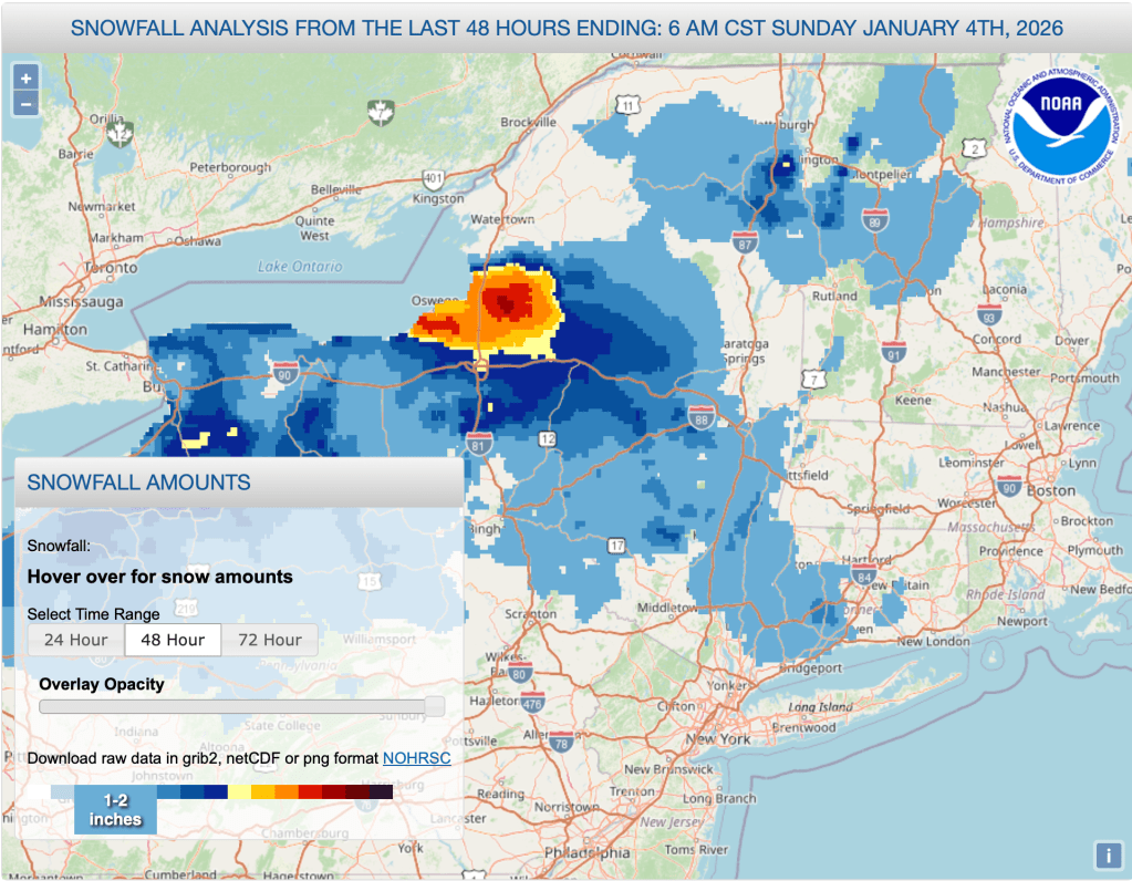
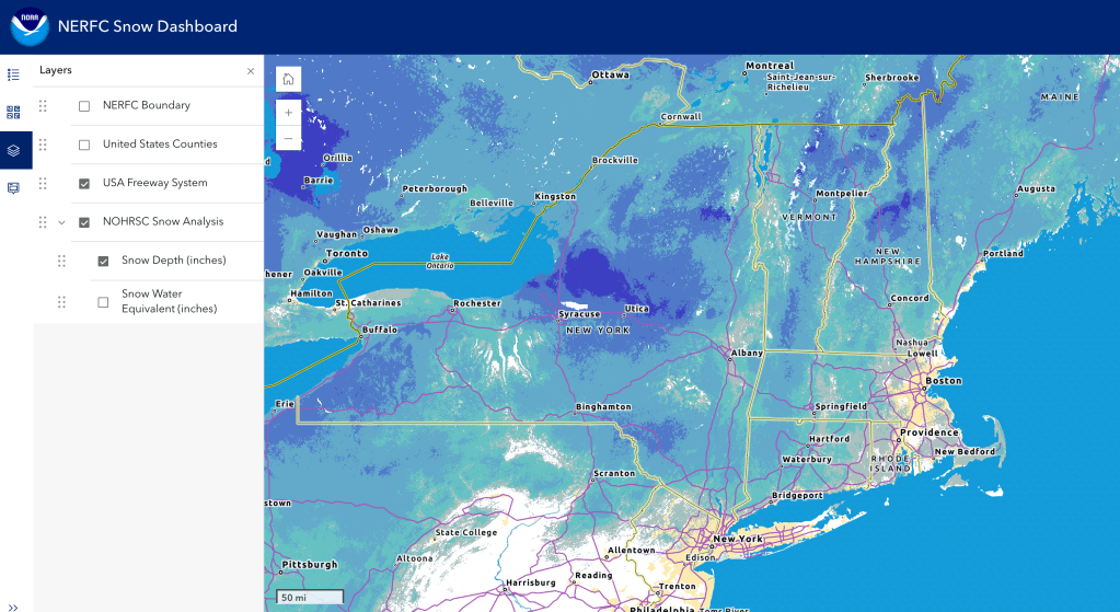
Hit up ‘State of the touring centers‘ or in the menu above for reported conditions as of today. Snow depth graphic below. The snowpack looks is blotchy and uneven, unusual for the ‘typical’ winter, but appropriate for this one.
Forecast
Monday: Light snow with some slight accumuation in the north, starting in the afternoon and lasting into the overnight. Winds will be calm.
Midweek: on Tuesday, warming temperatures are accompanied by a system that brings rain to the area south of the Adirondacks and the Massachusetts-Vermont/New Hampshire border, and snow to the north. Snow could change to wintry mix during the overnight period into Wednesday. Slightly windy in the midweek, with gusts in the southern regions up to 20mph.
Thursday evening to Friday: light rain and wintry mix develops across the northeast, including the far north. By Friday rain and rain showers will be prevalent over the entire region. Lightly gusty winds continue. Night time temps will be above freezing in the souther half of NY State and the southern New England states.

Saturday-Sunday: light rain or rain showers continue on Saturday. Coldest temps on Saturday could be close to or above freezing even in the far north, never mind the souther regions. Cooler weather arriving on Sunday could convert some rain to snow in the north. After a calm Saturday, wind gusts on Sunday could be over 20mph.
| Date | Northern NY VT NH mtns | Northern lowlands | Hudson Highlands to NYC metro |
| Mo 1/5 | Low to mid teens | Low 20s | Upper 20s to mid 30s |
| Tu 1/6 | Low 20s | Low 30s | Mid 30s to low 40s |
| We 1/7 | 20s | 30s | Mid to upper 40s |
| Th 1/8 | 20s | 30s | Mid to upper 40s |
| Fr 1/9 | Upper 20s to low 30s | 40s | Upper 40s to low 50s |
| Sa 1/10 | Mid 20s to low 30s | Low 40s | Upper 40s to low 50s |
| Su 1/11 | Teens to mid 20s | 30s | Upper 30s to low 40s |
