
I can’t really ski –
Got a pari of snowfeet if you need;
The wind’s so fierce my face might freze –
I have a nice buff here for thee;
Are you sure where we’ll go when we cross this snow?
A little place with hot chocolate and marshmallows;
‘Cause baby, it’s cold outside!
Once again, the heroes at Minnewaska have saved XC skiing for downstaters. With a bit of new snow on top, they regroomed all trails, and set tracks on most Conditions reported as ‘Good to Very good’.
This post is about conditions for Jan. 1 2026, and forecast for the next few days. See jump links to Conditions and Forecast.
How’s the skiing in general?
The best conditions belong to those areas that escaped some of the rain and got 4″ or more of new snow – areas such as the Tug Hill, the interior of the Adirondack High Peaks, and a tiny portion of Vermont’s southern Green Mountains.
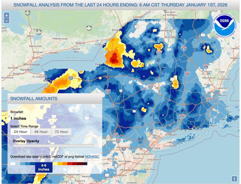
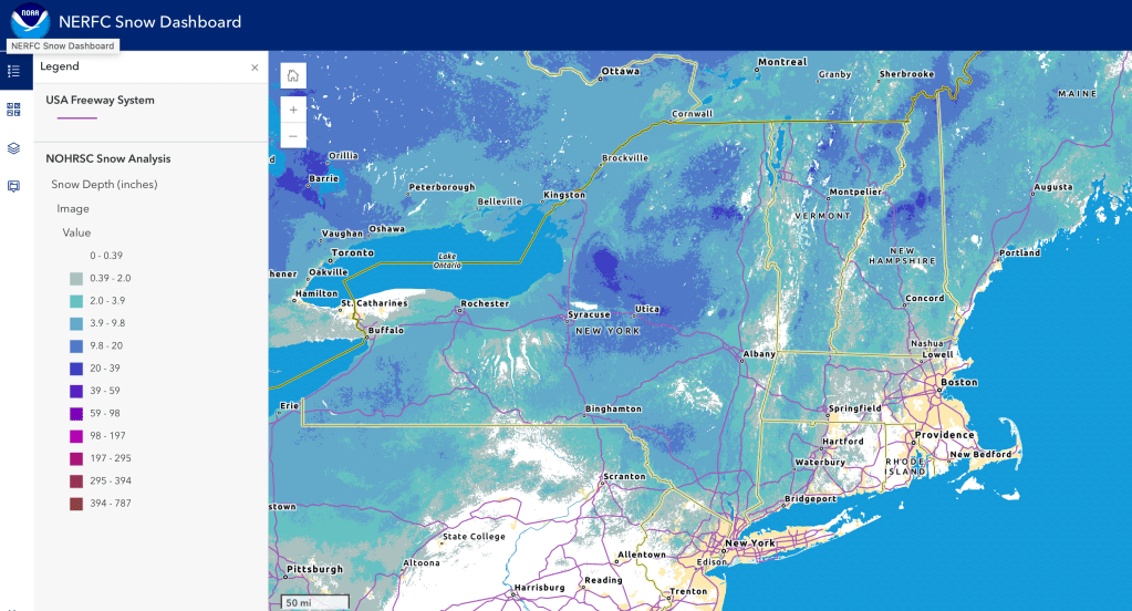
Debris clean up continues from the rain and wind of the last couple of days. In areas where the new snow is thin and grooming is not thorough, the soid base underneath could prove formidable. Hit up ‘State of the touring centers‘ or in the menu above for reported conditions as of today. Snow depth graphic below shows gererally pretty thin cover, but let’s be thankful that the cold weather has kept some base around to regroup.
Forecast
Cold weather stays with us through the next several days, before a warming trend starting Tuesday. Strong localized wind gusts through today, especially for eastern New England, with gusts of 40+mph.
Lake effect snow for central and upstate New York through the weekend. The Tug Hill could get another 15-20″ of snow by Saturday. Strong but less forceful wind gusts persist through the weekend before abating early in the week.
Chance of light snow across the region on Monday. A different aystem with precipitation likely to arrive in conjunction with warming temps during the middle of next week. This will mean rain, wintry mix, and possily some snow, depending on latittude ane elevation Winds pick up a bit during this time.
| Daytime highs by date | Northern NY VT NH mtns | Northern lowlands | Hudson Highlands to NYC metro |
| Fr 1/2/26 | Single digits to low teens | Mid teens | Mid 20s to low 30s |
| Sa 1/3/26 | Teens | Low–mid teens | Upper 20s to low 30s |
| Su 1/4/26 | Teens | Upper teens | Upper 20s to mid 30s |
| Mo 1/5/26 | Low 20s | Upper teens | Mid 20s to low 30s |
| Tu 1/6/26 | Mid 20s | Low 30s | Upper 30s to low 40s |
| We 1/7/26 | Low 30s | Upper 30s | 40s |
| Th 1/8/26 | Uppere 20s | Mid 30s | Upper 30s to low 40s |
