
Update 12/24:
Some touring centers are open today, some not. Areas that received more snow and less wind tended to fair better, but if snowpack had melted down and refrozen, the judgement swung toward closing or at least a ski-at-your-own-risk advisory.
Locally, nothing is open within a couple of hours’ drive. Minnewaska trails are solid ice, and High Point lost too much snow.
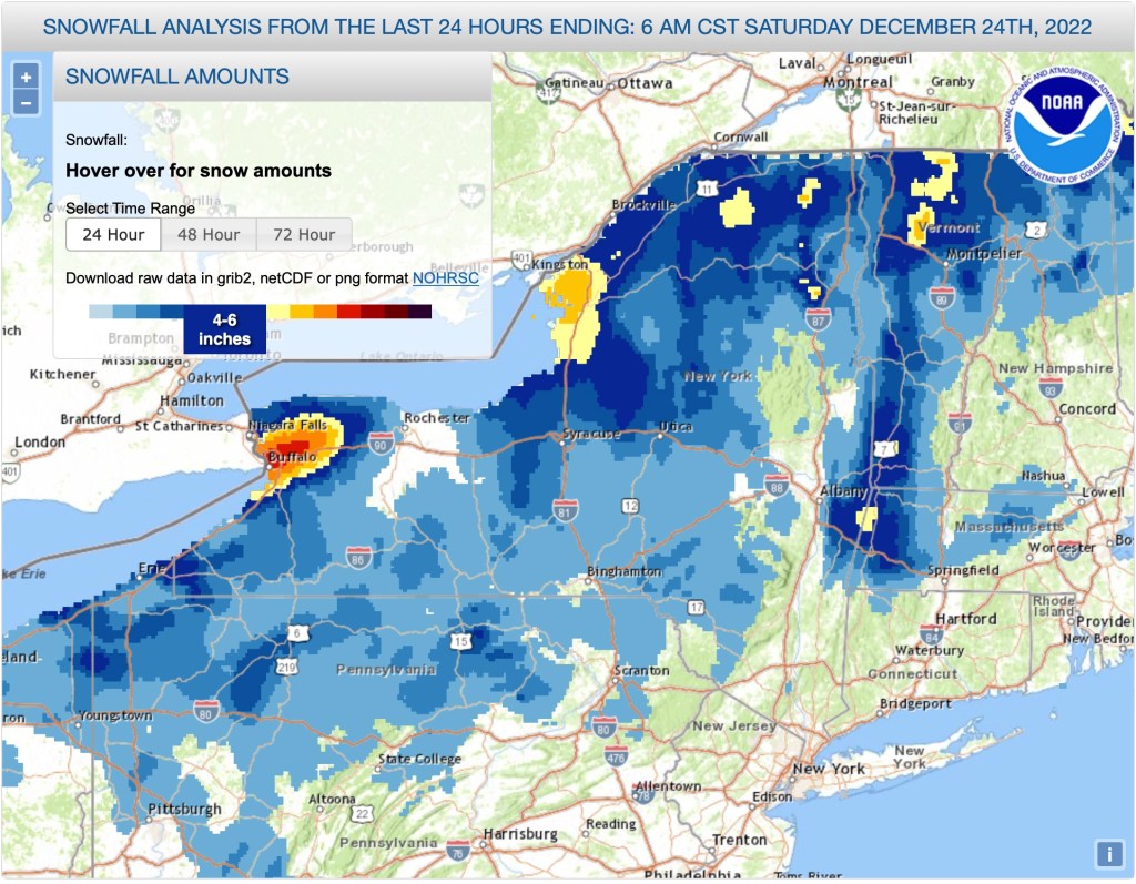
24-hour snowfall total gives some idea of areas that did a bit better in terms of snow vs. rain, but doesn’t account for blowdown nd power outages:
Original post below
Unless you’ve been hiding in a secure, undisclosed location without communications, you won’t have missed the weather warnings. Needless to say yesterday’s rain, today’s wind, and tonight’s temperature drop will make for some iffy conditions over the next couple of days.
A few near-term weather predictions for the region, just to get it on record.
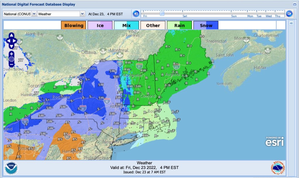
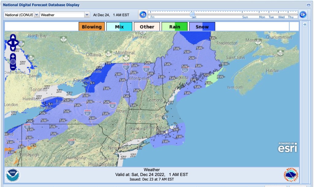
Weather shifts rapidly from rain to cold and clear
Rain across much of the region tapers off, and lingering precipitation may shift to snow as the cold front pushes in from the west, before stopping.

Primary hazards for the region, today through tonight
Three images showing the primary hazards for the region at 2pm and 5pm today, and 5am Saturday, illustrate the changeover from wind to flooding and cold as the immediate concerns.


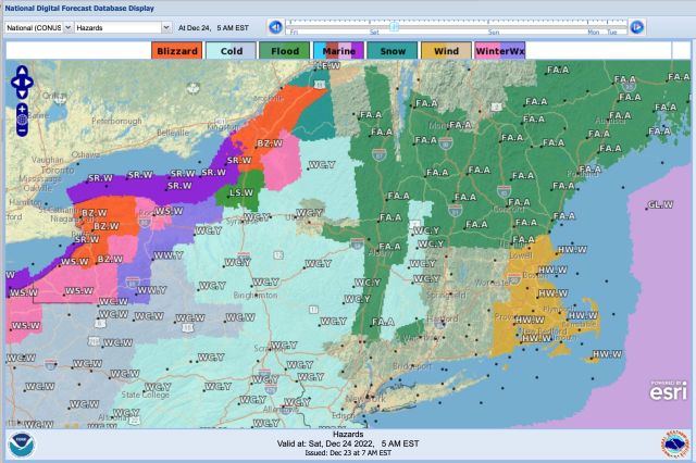
Be mindful of windblown snow/mix, freezing of standing water by later this evening, and potential for flooding in some areas.
