
This post contains section links to Conditions and Forecast.
Summary
“Fast” and “Challenging” are the adjectives for this week’s ski conditions. The “old skis recommended”, advisory remains, as in: don’t bring your brand new race skis out to play yet.
Resorts seem to have saved their efforts for the holiday week, as a number of areas are reporting significantly more trails open and better conditions than last week. Unfortunately it looks like there’s going to be rain across most of the northeast on New Year’s Day, and that could make things pretty sketchy until the next big snowfall.
Conditions
BETA report as of 12/26 says “fast” and “challenging”. Mountain areas have been getting some dusting of snow, usually about 1″ on each of the last couple of nights. Light snow this morning in the Green Mountains turned to rain late this afternoon.
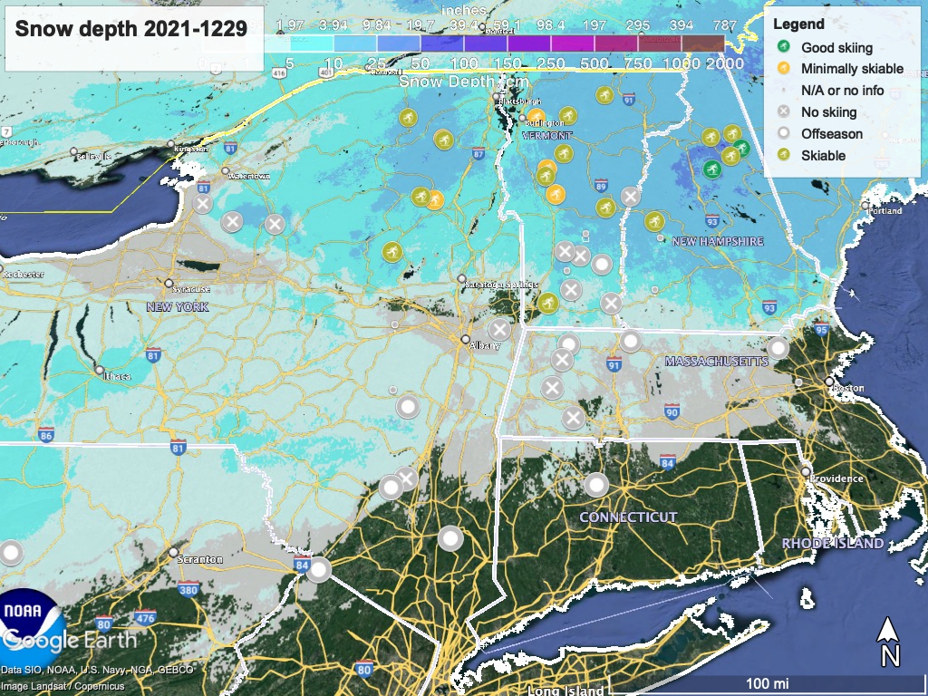
Hit up ‘State of the touring centers‘ or in the menu above for reported conditions as of today. Snow depth graphic below:
Forecast
Rain likely on New Year’s Day (Saturday). The rain could convert to snow during the overnight, and snow showers could continue across northern regions on Sunday afternoon and into the evening, from the Tug Hill through the Adirondacks and portions of the Green and White Mountains. Snow could fall over broader region toward the south as the precipitation moves eastward across New Hampshire and Maine.
Rain followed by snow will make conditions ‘challenging’ once again, unless groomed or softened. But hey- it adds to the base, right?
Monday and Tuesday will turn colder and drier, but a warmup is expected for the midweek. Despite that, there’s a modest chance of snowfall late next week in the Tug Hill, portions of the Adirondacks, and Green Mountains. Keep your fingers crossed.
