
This post contains section links to Conditions and Forecast.
Summary
Snow coming, but not the temperatures we need to keep most of it. Carpe ski’em. Good time to be a freelancer.
Conditions
Craftsbury and Gore Mountain have minimal manmade loops available as of today. The situation should improve dramatically by Sunday however, with significant snowfall expected from the Adirondacks through to the Green and White Mountains. Lesser amounts in lower elevations of the north country, and minimal accumulation south of Albany and the MA-VT/NH border
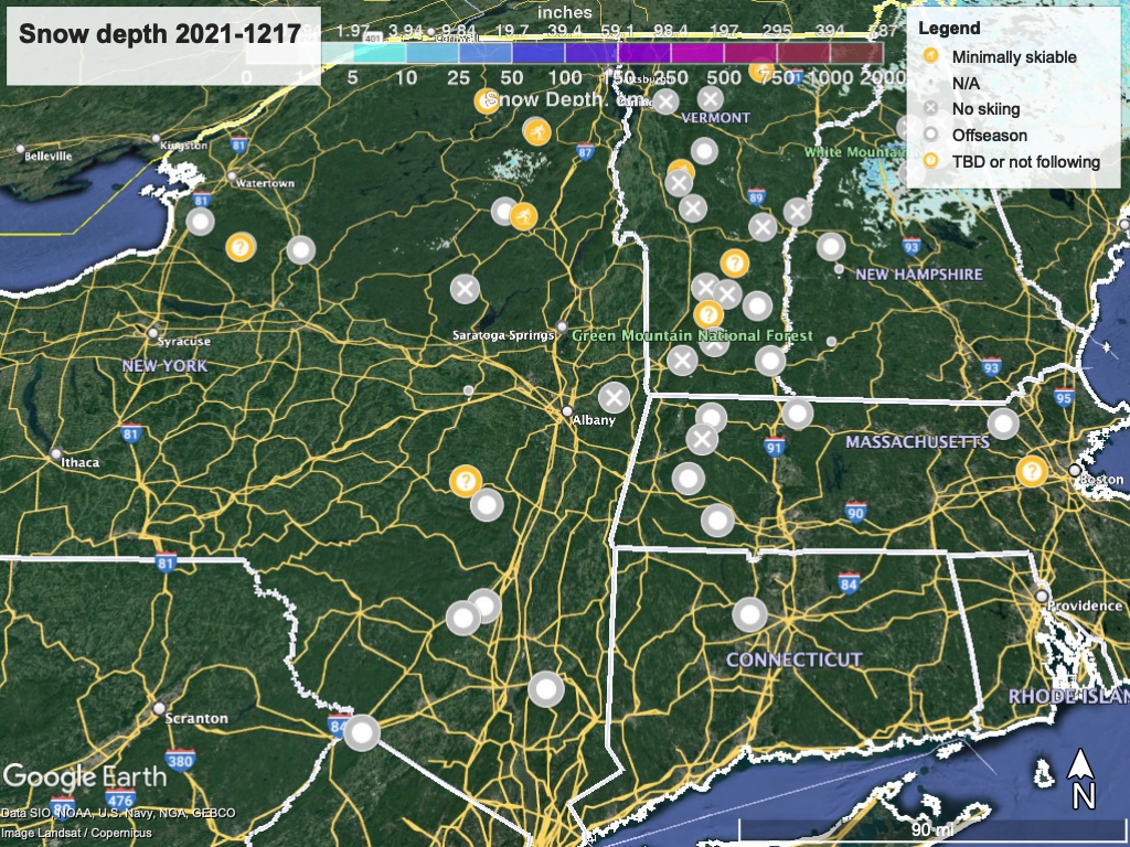
Hit up ‘State of the touring centers‘ or in the menu above for reported conditions as of today, except where noted in the details. The picture doesn’t get much worse than the snow graphic below:
Forecast
Precipitation arrives starting from the southwest early Saturday and continuing into Sunday. Southern and low-lying areas will primarily get rain or wintry mix, while the north country and higher elevations could see some heavy snow. 4-8″ forecast from the Adirondacks thru the Green Mountains, with 2-3″ for Albany and western MA. Some ice accumulation expected in the Catskills and western MA as well. During the day Saturday, snow in many areas will change over to rain.
The very northernmost parts of NY, VT, and NH could get a bit of snow on Monday night. A broader storm arriving from the west on Wednesday night will bring more snow across the Tug Hill plateau and northern NY, VT, and NH.
Temperatures will flip above freezing in the daytime (30s to 40s) and below at night for much of the region. As is typical, daytime temps on plateaus above the river valleys and mountain areas will be colder, possibly below freezing on some days.
