
Summary
Easter is this Sunday and the Waterville Valley Ski Touring Center director’s note says: ‘Stick a fork in it’ for this season. If you really want it you can ski in a couple of places- for groomed trails only Mt. van Hoevenberg is still up, with its 5k manmade loop. State parks and other public lands up north and at elevation may still have some cover.
Keep the gravel and shovels handy for one more week. A late-spring storm could put a few inches down on Thursday night in the most northern and higher elevations of the northeast, meaning a shot at skiable conditions in April on ‘rock skis’ for a few lucky folks.
Conditions
BETA report is hanging hope on a late-season snowstorm. The High Peaks is in a zone where several inches of snow could fall after the rains midweek. Had our region not experienced two weeks of above-normal temps, many areas might have kept a base that could get a refresh later this week. Ah well.
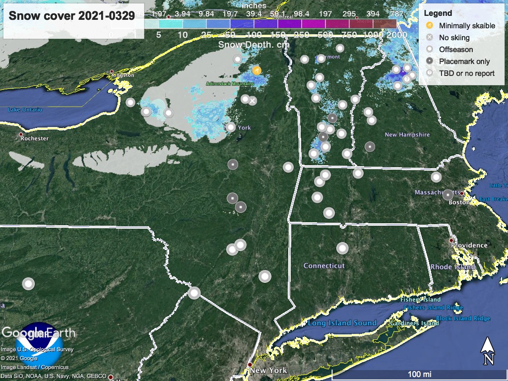
Because I’m tracking the season from open to close, ‘State of the touring centers‘ is updated, for what it’s worth. The last bits of the snowpack are shown in the graphic below:
Forecast
Blustery today (Monday) and cool. Spotty snow showers early in the day. Areas at elevation as far south as Lake Minnewaska could get a few inches of snow.
Significant precipitation expected starting Wednesday, with some possible river flooding due to rain and snow melt. By Thursday late afternoon, precipitation could become snow in far northern New York and Vermont, where elevated areas might get 6″ of late-season snowfall by Friday morning.
