
Groundhog Day 02-02-2020, and one of only 12 palindrome dates this century. Bonus: it’s a palindrome whether you follow MM-DD-YYYY or DD-MM-YYYY format.
It’s also a day to view the movie ‘Groundhog Day’, in which the main character repeats the same experiences day after day, and only by observing the smallest details over and over does he gradually realize true meaning in life. Kind of like skiing cross-country. And now back to regularly scheduled programming.
Summary: Generally overcast weather and precipitation should help sustain or even improve skiing conditions in the north country and northern New England over the course of the week. How much it helps skiing in the sub- 4-hour drivability range is hard to guess right now.
I should have added Pineridge to my list of the best-and-closest centers earlier this week, but otherwise I’ll ‘groundhog-day’ the places within a reasonable drive-time:
Good conditions still to be found most places north of Albany and the MA-VT/NH border, including Lapland Lake, Garnet Hill, the always-reliable Prospect Mountain, and at never-say-die Notchview.
Feb. 1 weekend ski conditions and forecast
Hit up the ‘State of the touring centers‘ for the details on touring centers. BETA reports states backcountry conditions in the ‘dacks should be about the same as earlier in the week, with some chance of a dusting of snow from this weekend. Specifically: “Avalanche Pass has been regularly skied and will only improve with a few more inches at higher elevations, though the Marcy Dam truck trail is still the better approach for nordic touring into that area.”
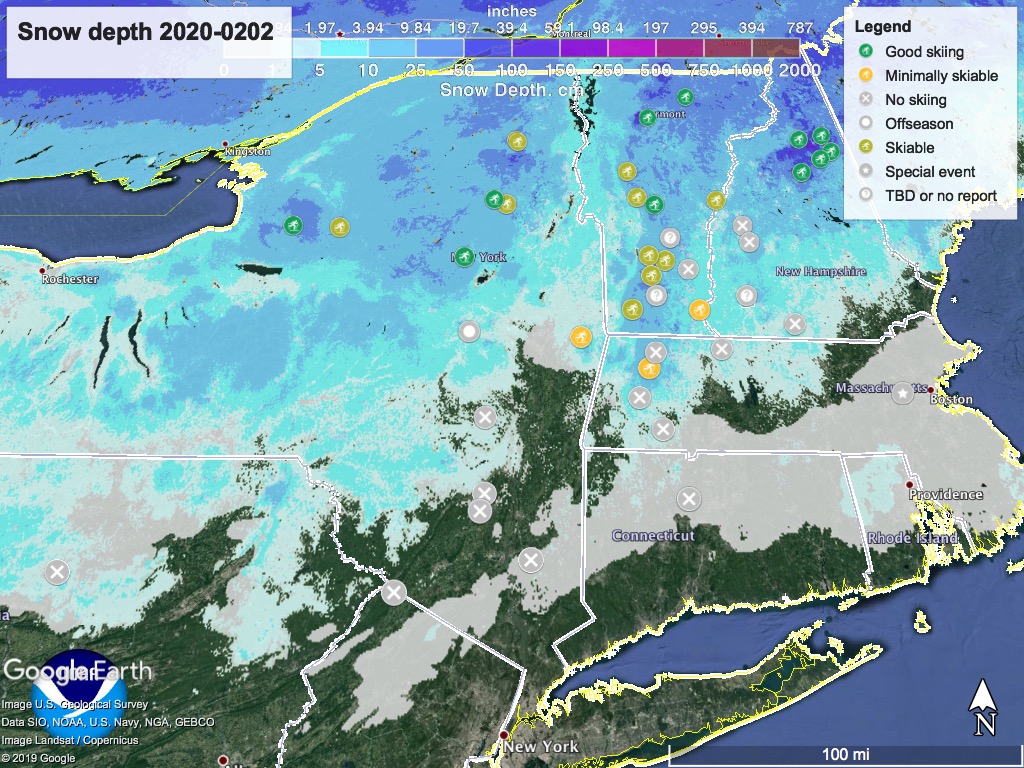
Here’s the snow depth graphic for today:
Forecast: Today, lake effect snow showers in central NY and Tug Hill, with some light snow showers through the north country and New England, possibly as far south as the Catskills. These will finally dissipate in the far north by Monday midday.
Rain comes into the region from the southwest Tuesday morning. The High Peaks and northern New England may see more of a wintry mix. By early Wednesday, the rain will convert to snow and wintry mix more generally across the northeast.
Snow showers could continue from the mid-Hudson valley northward Wednesday night, before flipping back to rain and wintry mix on Thursday south of the High Peaks and northern New England. However, snow showers and snow may continue in the north country through Friday and Saturday, so keep a ‘weather eye’ out for this as the week goes on.
Weekday daytime temperatures will seesaw from 30s in the far north to 50s in NYC early in the week, dipping to range from the 20s to 40s midweek, and back up again for the weekend. In other words, a warmish February week.
Thanks for reading on Groundhog Day;
Thanks for reading on Groundhog Day.
