
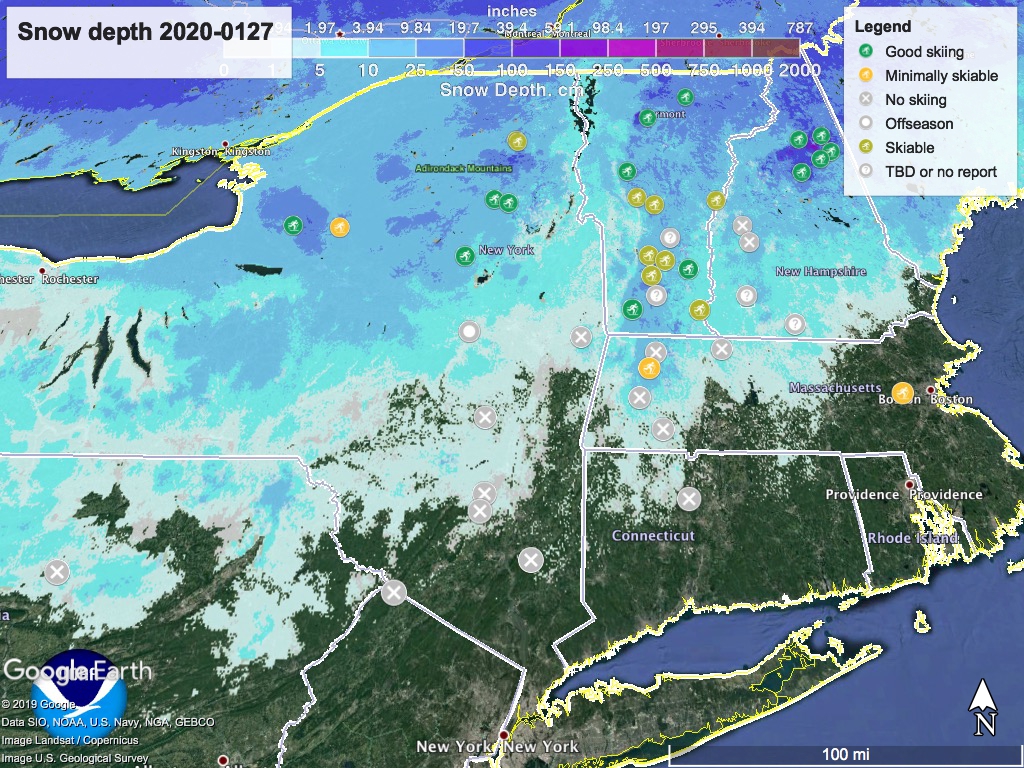
Summary: From the perspective of most cross-country skiers living in the valleys, the weekend looked disastrous. However, last night and this morning snow showers have significantly improved the outlook of some touring centers. It tended to do the most good at Osceola and the southern Adirondacks, as well as the White Mountains. A few places in Vermont also got improved skiability from snowfall in the last 24 hours.
Notchview and Prospect Mountain are skiable and just within a daytrip’s reach, and several within the 36-hour getaway radius have good skiing, like Lapland Lake, Garnet Hill, even Gore Mountain. Check out the ‘State of the touring centers‘ for details. Here’s the snow depth graphic:
It also helps to get a skier report- although previously marked as ‘No skiing’, a skier posted in the mhvxcs Google group that Minnewaska’s Upper Awosting trail was skiable on Saturday morning, albeit with bare spots. I’m guessing it’s not skiable today, but it held up pretty well. BTW, no word on backcountry, at least from BETA.
What’s up for the rest of the week? Well that’s actually part of the better news, provided you can do a midweek getaway.
Forecast: light snow in central and northern NY and VT today (Monday) and early Tuesday. Mostly sunny and a bit cooler through the midweek. Rain and snow arrive Friday evening, but could produce some snow accumulation from across the region north of Albany and the MA-VT/NH border.
For the workweek, daytime temperatures cool down to 20s and even teens in the far north and mountains, while remaining above freezing south of the Catskills. The weekend of Feb. 1 will be warmer, with the far northern areas reaching the high 20s or even slightly above freezing, while downstate NY and NYC metrol will be in the mid-40s.
Thanks for reading.
