
Midweek snoozers are weekend losers, as some ski areas with good skiing a few days ago have closed trails due to the rain and warm weather. But the news isn’t all bad: conditions will dry out over the weekend as temps fall back toward something closer to ‘normal’, so areas that manage to retain snow may reopen by Christmas day.
Snow depth
The key characteristic for nordic skiing is the amount of snow there is to work with. Fortunately our fellow citizens at NOAA produce a fine graphical map:
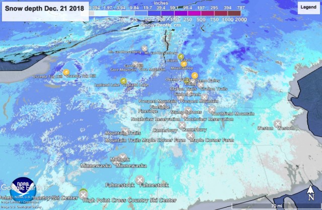
The location of ski touring centers within driving distance are indicated, with icon styles and color to indicate skiing conditions. Unfortunately, because I’m not a whiz with the Google APIs and Javascript, it’s a static map output from Google Earth, without much landmark information.
Touring center status
Last spring I started working on way to report the ‘state of the skiing’ that would add visually meaningful geographic info and be simpler for me to update than the list format. In the map below you can see which touring centers are open at a glance, along with state boundaries and major highways. Like all Google map embeds, it’s zoomable and the icons are clickable:
For a static list of touring centers categorized by range, go up to the menu bar
