
There’s some great spring skiing to be had, but it’s a few hours noth of NYC and the window is disappearing fast. It’s been a great run in the downstate region, and more than ever, it’s a ‘carpe ski’em’ or ‘making lemonade’ kind of weekend. Locally, the word is:
- Minnewaska has not reported as yet, but conditions if any will be minimally skiable.
- Mohonk Mountain House has only two trails open for skiing – Cedar Drive and Overlook Road.
- Fahnestock and High Point trails are closed for skiing.

In NYC nothing remains of the big snowstorm that took place less than two weeks ago. C’est l’hiver, c’est printemps. This post is about conditions for Mar. 6 2023, and forecast for the next few days. See jump links to Conditions and Forecast.
What will the skiing be like?
The good news is that up north temperatures remained a wee bit cooler, and areas across the northern New York, Vermont, and New Hampshire got anywhere from a dusting of snow to several inches. From the middle of this week through today there has been some truly great spring skiing. Snowfall for 24 hours prior to Friday morning tells part of the story:
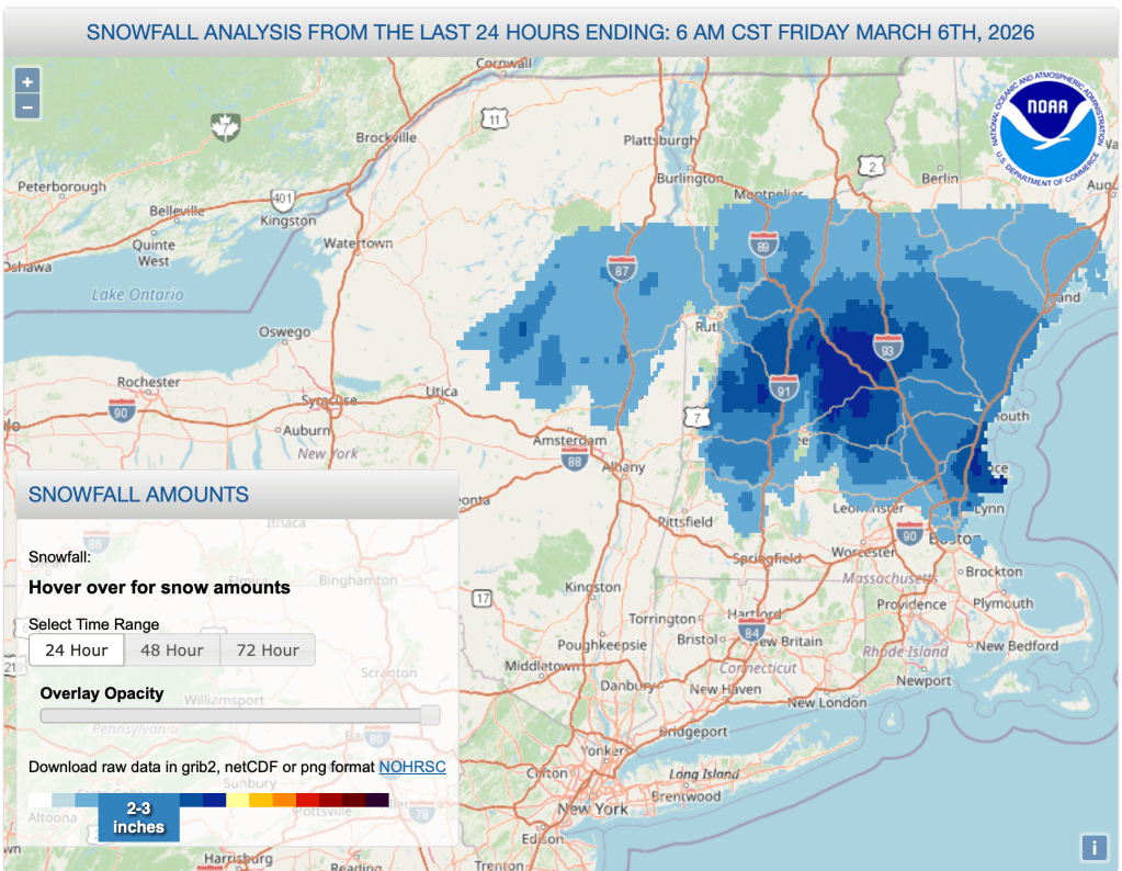
Further south there was more rain or sleet than snow:
We live in New England, right? Sleet is a durable, skiable, workmanlike surface; just doesn’t have the cachet of powder. It is both good for skating and classical techniques. We are grooming it in this morning and expect that most trails will be newly groomed.
Notchview conditions report Fr 3/6/26
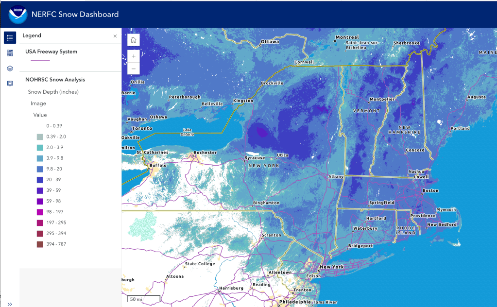
It’s a Maxiglide and klister kind of day. Hit up ‘State of the touring centers‘ or in the menu above for reported conditions as of today. Snow depth graphics below:
Upcoming weather
Summary: shift from cold to much warmer temperatures, peaking in the 50s and 60s across the northeast by midweek. Multiple systems of rain through during the weekend and early in the week, after which colder temperatures begin to creep back in, but not cold enough to prevent some extended rain and rain showers for the end of next week.
Night time temps in the southern half of NY and in southern New Englandm as well in the upper Hudson and Connecticut river valleys will be will above freezing during the next few days, but the far north and especially at elevation will remain just cool enough that we can hope the snowpack there will make it through.
Gory details:
Friday tempertures are effected by cold air that went south through river valleys on Thursday, resulting in the snowfall in mid-northern regions on Thursday afternoon and evening. Light snow in eastern Vermont and New Hampshire Friday morning. Colder air and temps will remain in the east when a front arrives late Friday evening. This will mean rain across the western areas (NY, Hudson valley and Taconics) and icing further east. Freezing rain is a concern for Friday night in the inland and northern areas.
Saturday’s weather creates temperature gradient that puts overall cooler temps to the ‘downeast’ quadrant of the region. Icy conditions in Vermont, New Hampshire, Massachusetts, and Maine continue till late morning. Some feezing drizzle possible in northern areas of New England. Rainy conditions may lighten up a bit during the day, but more precipitation, this time all rain, will arrive across the northeast by Saturday evening. Some very strong wind gusts of 40+mph for far northern NY and VT.
Sunday temperature gradients will be more normal, cooler in the northwest quadrant of northern NY state. Mostly dry day for Sunday and Monday. Wind gusts on the mountain peaks in the 25-30mph range.
On Tuesday colder air begins to have an effect in the far northern region. Another front comes through from west to east Tuesday evening, mostly rain and rain showers. Winds will be generally calm.
As precipitation continues into Wednesday, colder air entering the region could convert rain showers to wintry mix/snow in the far north. Night time could convert remaining rain showers to snow from the southern Adirondacks and southern Green Mountains northward, before coming to an end Thursday night. Wind gusts will gradually increase starting Wednesday, with gusts reaching 20+mph in the low-lying areas and 30+ at elevation by Thursday.
Friday the 13th may bring another front with rain and snow showers. Still a long time away and foorecast could change by then. The end of next week looks to be at ‘normal’ temps or below. Long-range prediction by WPC estimates that cooler than normal temps are likely March 13-19.
| Date / Daytime high temp | Mountains in northern NY, VT, and NH | Lowlands from central NY to NH interior | Hudson Highlands to NYC metro |
| Fr 3/6 | Upper 20s to low 30s | Mid 30s to low 40s | Low to mid 40s |
| Sa 3/7 | Mid to upper 40s | Mid 40s to low 50s | Upper 40s to mid 50s |
| Su 3/8 | 30s | Low 40s to low 50s | Upper 50s to low 60s |
| Mo 3/9 | Mid 30s to mid 40s | 50s | Low to mid 60s |
| Tu 3/10 | Upper 30s to low 40s | Upper 40s to upper 50s | Mid to upper 60s |
| We 3/11 | 30s | Low 40s to low 50s | Upper 50s to mid 60s |
| Th 3/12 | Upper teens to upper 20s | Low 30s to low 40s | Low to mid 50s |
| Fr 3/13 | 20s | Upper 30s to low 40s | Mid to upper 40s |
