
Spring skiing! Winter returns late this weekend, then more spring skiing next week. Expect to do some relaxing in the upcoming days.

All the areas within day-trip distance to NYC are open and the skiing is good to very good:
- Fahnestock reports about 40% of trails are groomed. Tracks to be set Friday. About 3″ new snow Wednesday.
- High Point is opne
- Minnewaska reports conditions ‘very good’ overall. Smiley trail remains ungroomed.
- Mohon Mountain House has groomed and tracksuit almost all trails Wednesday or Thursday.
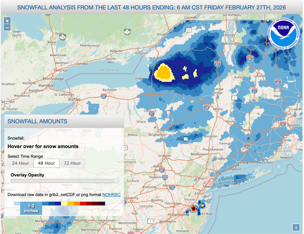
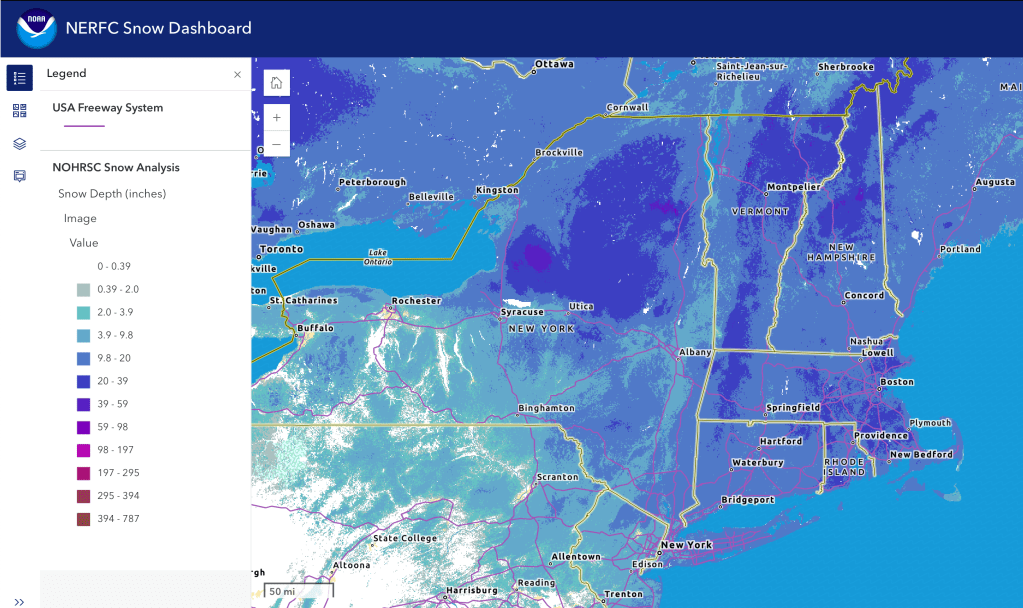
This post is about conditions for Feb. 27, 2023, and forecast for the next few days. See jump links to Conditions and Forecast. Will update ‘state of the touring centers’ later today.
What will the skiing be like?
Skiing has been very nice, mild wintertime up north and springlike in the southern areas. A small to moderate refresh of snow Wednesday has kept trails in great condition in the northern elevated areas. Temps for the end of the week continue to warm up throughy Saturday. With the warmer temps snow will get quite wet and much slower. Wax for warm.
No-wax skis and maxi glide recommended for Friday and Saturday, and again for Tuesday and Wednesday assuming it doesn’t rain.

Leave it to Good Housekeeping to do a video tour of Yolanda the wax truck, the waxing techs’ ‘home on the range’.
Rewax for Sunday for new and cold snow A light to moderate snowfall for early Sunday will make for some nice classic or skate skiing through Monday. Then prepare to rewax again later in the week as temps warm up, and wet weather moves in.
Let’s hope the snowpack holds up through the first week of March.
Upcoming weather
A ‘taste of spring’ is on the way toward the middle of next week. But before that, a shot reminder of winter and a bit of snow. Details below.
Clear and dry weather through Saturday. A rapid drop in temperature for Sunday thanks to a cold front from the west. Light snow showers will accompany the movement of the front as it goes west to east o overnight Saturday into Sunday, quickly moving across the region and exiting by the late afternoon. This system will bring snow showers to much of the northeast. The heaviest accumulation will be in the ‘middle north’ of the Catskills, Taconics, Berkshires, and southern Greens, with possible accumulation of a couple of inches of snow as far as the Adirondacks and northern mountains of Vermont. . Snowfall will overspread the entire northeast. Winds will be light with some mild gusts Friday. Saturday wind gusts in the far north could be 30-35mph. Sunday will be a bit less breezy, with gusts up to 20+mph.
Daytime temperatures start trending up on Monday as we march toward spring (couldn’t resist the obvious) and otherwise partly sunny in the south, mostly sunny in the north, with calmer winds.
Potential for two back-to-back systems bringing a mix of rain and some snow starting Tuesday morning, and continuing into Thursday as rain. The precipitation from this system will start from the southwest and move gradually northward and eastward. Cloud cover may prevent viewing of a ‘blood moon’ lunar eclipse from 6-6:30am on Tuesday.
Tuesday’s perpitation could start as snow in the downstate region but will flip over to wintry mix. The northern areas will be spared of anything but snow till the second system arrives late Wednesday. Winds will become more active and variable from midweek on, with periods of gustier winds interspersed with calmer breezes.
By Wednesday late afternoon the southern and western parts of our region will be getting wintry mix and rain showers while the northern regions will get snow showers. By Thursday the entire northeast starts to get rain showers. Forecast confidence is low, but a relatively small amount of total rain anticipated.
Night time temperatures will stay below freezing through most of next week, so we need just a bit of luck for the downstate to make it through another week of winter. Unfortunately the Weather Prediction Center 6-10 day as well as 7014 day guidance is for temps and precipitation likely to be above normal for this time of year. Stay tuned and hope for the best.
| Date / Daytime high temp | Mountains in northern NY, VT, and NH | Lowlands from central NY to NH interior | Hudson Highlands to NYC metro |
| Fr 2/27 | Upper teens to upper 20s | Mid 30s to low 40s | Upper 30s to low 40s |
| Sa 2/28 | Mid 20s to mid 30s | Upper 30s to upper 40s | Upper 40s to low 50s |
| Su 3/1 | Single digits to teens | Teens to low 30s | Mid to upper 30s |
| Mo 3/2 | Single digits | Teens to mid 20s | Mid 20s to low 30s |
| Tu 3/3 | Teens to mid 20s | Low to mid 30s | Mid to upper 30s |
| We 3/4 | 20s | Upper 30s to low 40s | 40s |
| Th 3/5 | 20s to low 30s | Upper 30s to mid 40s | Mid to upper 40s |
