
Last time Minnewaska Park updated conditions was Jan. 8 and conditions were poor. After the rain and warm temps it’s reptty doubtful skiing will resume unless there”s a few inches of snow. Closest skiable trails are at Prospect Mountain.
This post is about conditions for Jan. 11 and forecast for the next few days. See jump links to Conditions and Forecast.
How’s the skiing in general?
It wasn’t bad until the 8th, when weather turned warm. By the weekend rain and feezing rain fell across much of the northeast. It reduced the base significantly south of Albany and the MA border of VT and NH. Temps cooled a bti for Sunday, and isolated parts of the north country got a few inches of wet snow.
Soft conditions on Saturday turned faster and firmer overnight to Sunday morning. A number of spots in the valleys got what the Oak Hill report said was:
The full range of precipitation types
– Oak Hill grooming report Jan. 11
There’s cooler weather coming this week, but things won’t improve much without a decent refresh of snow. How likely is that? See the forecast below.
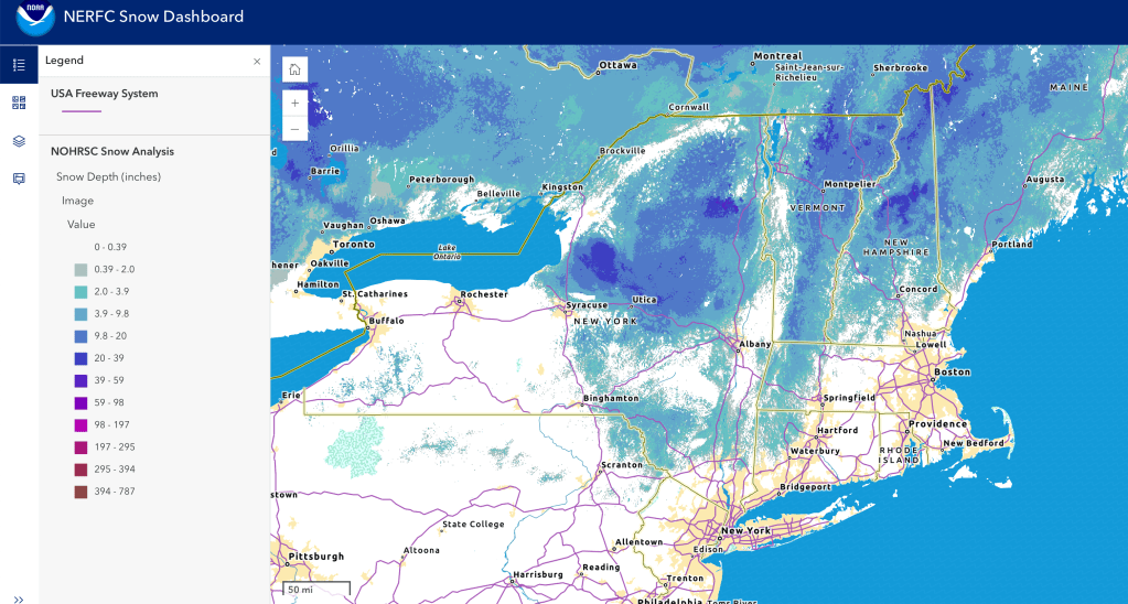
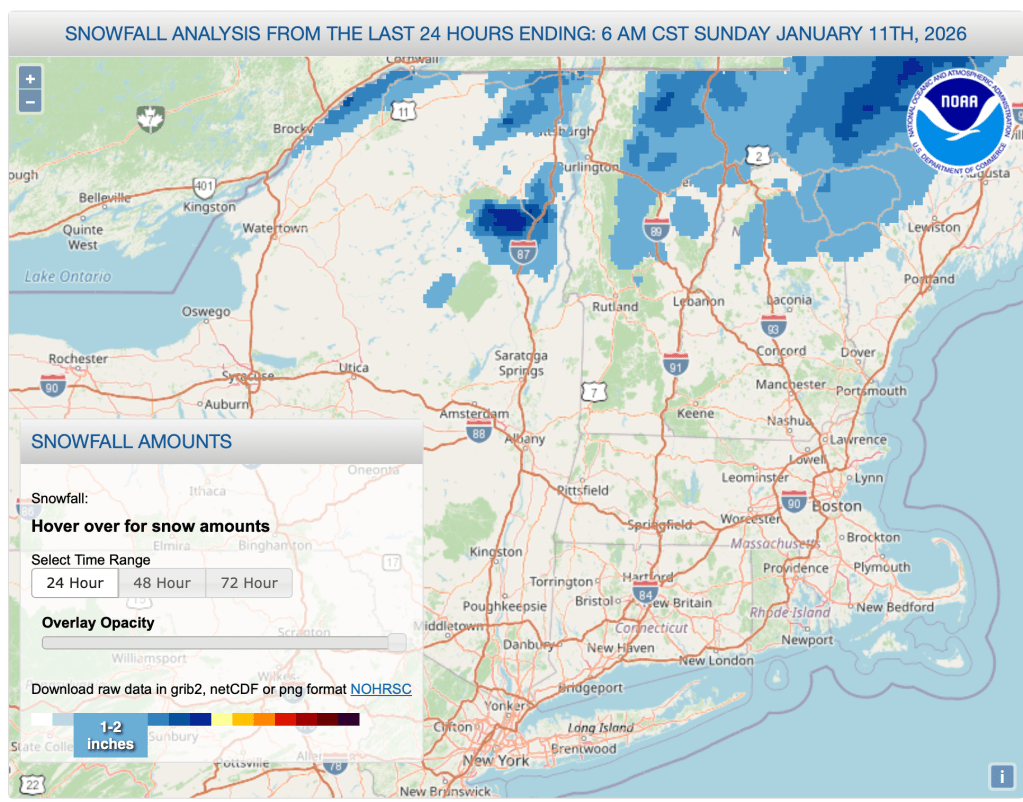
Hit up ‘State of the touring centers‘ or in the menu above for reported conditions as of today. Snow depth and 24hr snowfall graphics below:
Forecast
Possible light snow for the far northern areas in the beginning of the week. Lake effect driven snow likely across the Tug Hill and portions of central and northern New York State. In western Massachusetts and parts of New York and Vermont, gusts of 35-45+mph Monday morning, 24-30mph in the Green Mountains.
Rain showers, rain, wintry mix and some snow starting overnight Tuesday to Wednesday. Best chances for snow will be in the northern portions of NY, VT, NH. Gusts of 25-30mph in northern NY and VT.
Cold weather arrives from the west by Thursday, while warm moist air moves up off the cosat. The two systems will create a west-east temperature gradient and much warmer highs in the eastern half of our region. Precipitation will also be split with more snow to west and rain towards the east on Wednesday, gradually converting to snow showers over the course of Thursday. Greatest snow accumulation will occur over the Adirondacks and far northern Vermont. Valleys in southern Vermobnt and New Hampshire could have icy roads Thursday morning. Winds calmer for the remainder of the week.
Snow showers overspread the region by Saturday evening and continuing Sunday. Possible wintry mix in the NYC and coastal areas.
| Date | Northern NY VT NH mtns | Northern lowlands | Hudson Highlands to NYC metro |
| Mo 1/12 | Teens to low 20s | Low 30s | Upper 30s to low 40s |
| Tu 1/13 | 20s | 30s | 40s |
| We 1/14 | Mid to upper 20s | Upper 30s to low 40s | Mid to upper 40s |
| Th 1/15 | Teens | Teens to mid 30s | Mid to upper 30s |
| Fr 1/16 | Single digits | Teens to mid 20s | Upper 20s to low 30s |
| Sa 1/17 | Single digits to teens | 20s to low 30s | 30s |
| Su 1/18 | Teens | Mid 20s to 30 | 30s |
