
Get it while it’s here!
[Updated 10am 12/28] As of 8:30am Dec. 27:
- High Point is open with limited skiing. They received about 3″ new snow, and had gotten a few inches last Tuesday.
- Mohonk Mountain House trails are open for skiing, packed and tracked 12/27
- Minnewaska State Park received 10″ new snow. Trails regroomed 12/28 and Awosting, Castle Point, and Minnewaska trails have tracks. Very good to excellent conditions.
- Shawangunk Nordic Ski Association reports River-to-Ridge trail has not been groomed yet (as of 12/27).
- Fahnestock Winter Park, received 7″ new snow and about 50% of trails are open and packed for 12/28. No tracks due to thin cover.
Word from the Hudson Valley NY Skiers is that there’s 12″ new snow just outside Margaretville. Stay tuned. This post is about conditions for Dec. 27 2025 (with updates 12/28), and forecast for the next few days. See jump links to Conditions and Forecast.
How’s the skiing in general?
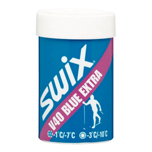
[Sunday 12/28] Up north the classic kickwax will still be somewhere in the Swix Blue range. In the south and valleys, it could be more like purple or red, or maybe just go with waxless. Looks like Sunday will be good skiing as the rain won’t arrive till late afternoon or evening.
[Saturday 12/27] Anytime the posted classic wax of the day is Blue Extra, you know it’s a fine day to ski classic style! Hit up ‘State of the touring centers‘ or in the menu above for reported conditions as of today. More about the lastest snowfall and graphics of amound and depth below.
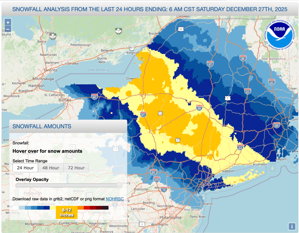
The major accumulation zone shifted northward and somewhat east from yesterday morning’s forecast. NYC barely got 2″ of snow, but eastern LI and coastal Connecticut got 6-8″. The better news for skiers is that regions from the the Hudson Highlands north of I-84 to the Albany region could have gottn as much as 12″ of snow. The Berkshires, southern Vermont, and ?? made out with a modest refresh of anywhere from 3-5″ of snow.
Reports in general are of ‘light, fluffy snow’, meaning a lot of compaction when grooming, but nice for first tracks when touring. Use your rock skis because there’s not a lot of base.
24-hr snowfall analysis shows a band of 8-12″ of new snow extending from the Tug Hill to the Taconic range, with a fringe of 4-6″ new snow from the southern Adirondacks through to southern Vermont and central Massachusetts:
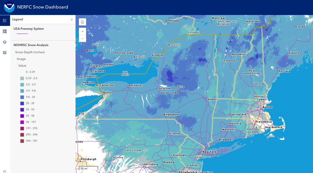
Meanwhile, the snow depth graphic below shows depth from 3.9-9.8″ across the region just north of NYC within a couple of hours’ drive:
Forecast
High temperatures in the downstate area will stay at or just above freezing today (Saturday). Temperatures will be trending upward for the next few days – highs downstate to about 40 degrees on Sunday and upper-40s on Monday before retreating back to around freezing on Tuesday. The north country will likewise see rising temps, to around freezing on Sunday and well above freezing Monday, with the valleys possibly in the 40s. By Tuesday daytime temps will go back down to the 20s.
For skiers the immediate issue is that a storm system with ice and rain arrives along with the warming temps. By Sunday evening much of the northeast will see some freezing rain and icing, while NYC and coastal areas will get rain.
By Monday morning a warm front will bring rain across the northeast including the far north, with possible exceptions at the highest elevations and the northernmost tip of New Hampshire. Rain will continue through Monday, with some of the remaining precipitiation converting over the snow or wintry mix in northern NY and New England by Monday night. Quantity of rain and ice accumulation could be substantial.
Precipitation ends as lingering snow showers for the north country on Tuesday, with some additional lake effect snow for upstate New York. Wind guss will pick up and ccould be very strong in some areas as the cooler weather comes into the region. Lake effect driven snow for upstate New York and Vermont is likely.
Temperatures for the latter part of next week will flirt with slightly warmer and cooler temps, more in line with Tuesday’s temps than Monday’s. A clipper system late in the week may bring snow showers for New Year’s Day.
Daytime temp ranges for the next several days:
| Date | Northern NY VT NH mtns | Northern lowlands | Sourthern regions & NYC |
| Su 12/28 | Low to mid 20s | Low to mid 30s | 30s |
| Mo 12/29 | 20s to low 30s | Mid 30s to low 40s | Mid 40s to low 50s |
| Tu 12/30 | Single digits to teens | Teens to 20s | Low 20s to low 30s |
| We 12/31 | Single digits to teens | Low 20s to low 30s | High 20s to mid 30s |
| Th 1/1/26 | Single digits to teens | Teens to low 20s | Mid 20s to low 30s |
| Fr 1/2/26 | Single digits to teens | Teens to mid 20s | Mid 20s to low 30s |
| Sa 1/3/26 | Teens to low 20s | 20s | High 20s to mid 30s |
