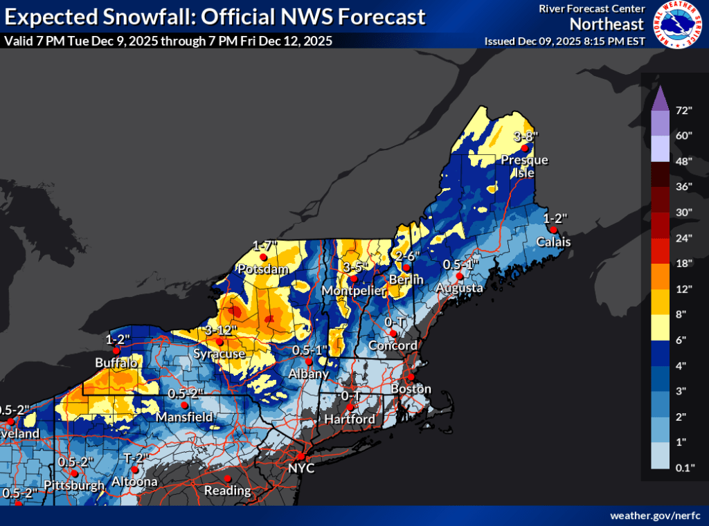
Forecasting for this week has been spot on. Canadian clipper moves out tomorrow morning, leaving a trace of snow to a couple of inches in the far north and mountains. At the same time a front will move in from the south, with more moisture and warmer weather for a day. The good news is a refresh of the base for northern NY State and New England for the weekend.
Snow could fall as far south as the Hudson Highlands, but most of the snow accumulation will occur in the mountains and further north. Rising temps Wednesday will mean a likely changeover of precipitation to rain for much of the region until nighttime. Gusty wiinds are expected, and the combination of snow, rain/wintry mix, and wind could make for hazardous roads.
Cold weather moves back in from the north and west for the latter half of the week, Some of the accumulated snow will help refresh the base, although groomers may have to work the surface a bit. Backcountry skiers may have some crust to deal with. Some additional light snow could fall Thursday and Friday, and it’s likely that temps will stay cold through the weekend.
Anticipated snowfall for the next few days: