
It’s not quite done yet – if you’re hoping to get a Cross-country ski outing this weekend, a few areas keeping it going for the weekend. Plus there’s the added (small) hope for some snow early next week. If not for that, things might look like the Bowdooin College XC ski team’s preseason practice:
This post is about conditions for March 21 2025, and forecast for the next few days. See jump links to Conditions and Forecast.
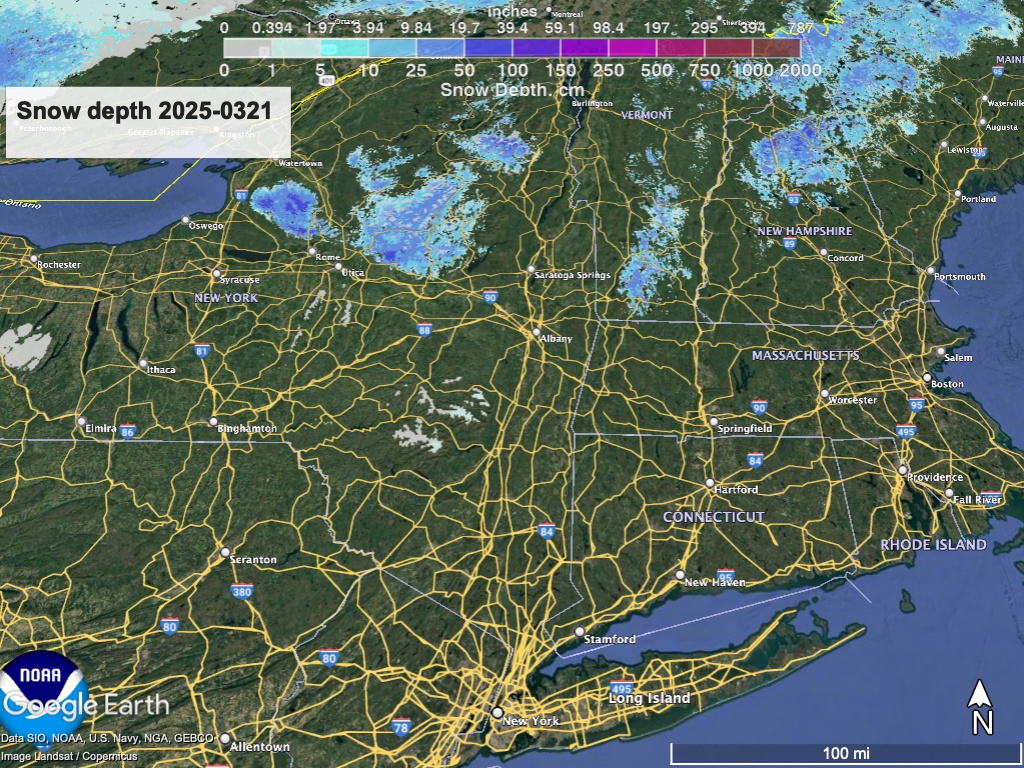
How’s the skiing in general?
It’s actually kind of impressive that a few areas have managed to keep some terrain skiable. Outside the Tug Hill plateau it’s in the most northern areas, at elevation, on manmade snow, or a combination of all three. The Tug Hill and southern Adirondacks seem to have the best coverage remaining, with a slim chance that Prospect Mountain will get just enough new snow to reopen for the weekend.
Backcountry skiing is very limited at this point. BETA report of 3/20 is basically saying ‘stick a fork in it’ for the season below 4000 feet. Backcountry skiing now is for the die-hards. Time for rec-heads to start kayaking and bike riding.
Hit up ‘State of the touring centers‘ or in the menu above for reported conditions as of today. Snow depth graphic below:
Forecast
Cooler weather returns next week as temperatures are forecast to be near or at seaonal levels. Night time temperatures in northern NY and new England will be below freezing, so that would limit the melt-off of remaining snowpack. The bullet points:
- A small system moves through on Saturday, bringing mostly rain showers. Any snow is likely to be just a dusting to an inch or so. Winds gusts of 30-35mph can be expected at elevation starting Saturday afternoon and lasting into Sunday.
- A more significant system arrives late Sunday or very early Monday, caused by a low centered on the Great Lakes and a war,mfront from the south. This will create a variety of precipitiion, possibly heavy at times. But don’t count on much more than a few inches of wet snow at higher elevations and the far north, interspered with rain.
- Upper level winds during the midweek may create a coastal low and scattered rain showers for portions of the northeast, probably affecting the southern and western regions (ie, NY, CT, MA, RI, VT) the most.
- Late in the week light rain and snow showers may occur across western and central NY, The Adirondacsk, and the northern New England states.
| Sa 3/22 | Su 3/23 | Mo 3/24 | Tu 3/25 | We 3/26 | Th 3/27 | Fr 3/28 | |
| Northern NY, VT, NH – Daytime temps | High 40s to high 50s | Low 30s to low 40s | 40s | High 30s to mid 40s | High 30s to mid 40s | High 30s to mid 40s | High 30s to mid 40s |
| NYC metro and southern New England coastline – Daytime temps | Mid 50s to low 60s | 40s | 50s | High 40s to mid 50s | High 40s to mid 50s | High 40s to mid 50s | Low to mid 50s |
Barring a much greater snowstorm next week than forecast, it’s looking like the season has reached in its finale. The last aria is being sung.

Thanks for reading! Remember to prep those skis for storage.
