
But here, upon this bank and shoal of time, we’d jump the life to come.
‘Macbeth’, William Shakespeare

Prespect Mountin is hanging on, and that’s closest to the NYC metro. I’ll be checking again midweek after the expected rain.
How’s the skiing in general?
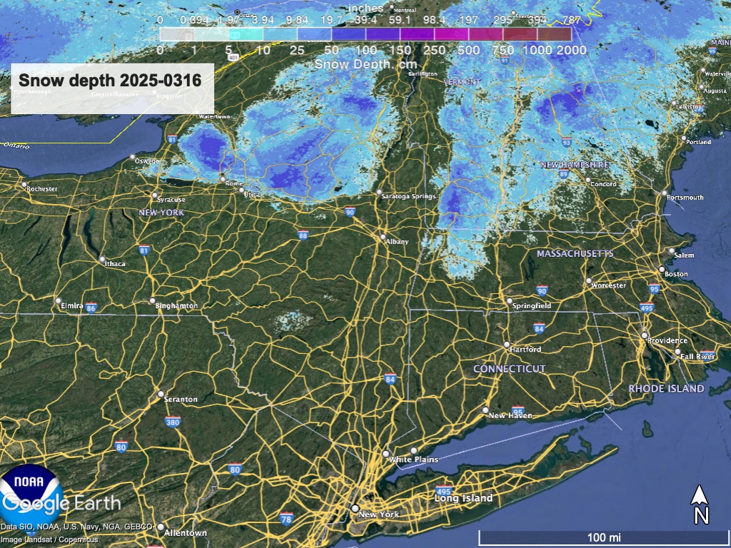
If you’re looking forward to some spring skiing, better get it right now. Conditions are probably not going to get any better than this until late in the week, and only for the north country if then. Hit up ‘State of the touring centers‘ or in the menu above for reported conditions as of today. Snow depth graphic below:
Forecast
Rain tonight and Monday. Warm weather through midweek with nighttime temps near to or above freezing from southern VT and NH southward. The north country has the best shot at keeping some snowpack and getting less rain.
Rain showers on Thursday, possibly with wintry mix by Friday, and a changeover to snow showers in nothern NY and New England when colder temperatures arrive for Friday.
The cold spell is brief, and a warming trend begins again on Saturday.
| Mo 3/17 | Tu 3/18 | We 3/19 | Th 3/20 | Fr 3/21 | Sa 3/22 | Su 3/23 | |
| Northern NY, VT, NH – Daytime temps | Low 40s to mid 50s | High 40s to high 50s | High 50s to low 60s | Mid 50s to low 60s | Mid 30s to low 40s | 40s | Low 40s to low 50s |
| NYC metro and southern New England coastline – Daytime temps | 50s | Mid 50s to low 60s | High 50s to low 60s | Mid 50s to low 60s | 40s | 50s | Mid 50s to low 60s |
