
Sugaring has begun, and we are transitioning out of the heart of winter. Late afternoon outdoors activity becomes possible for those with normal work hours. But will you be skiing or running or biking?
How much skiing is left in the snow-bank? Looks like we’re going to find out.
This post is about conditions for Mar. 6 2025, and forecast for the next few days. See jump links to Conditions and Forecast.
How’s the skiing in general?
[Updated March 7]
Two days of rain and wind required time to drain from the snowpack and a trail assessment for grooming.. Yesterday’s ‘?’ TBD marks on the ‘State of the touring centers’ map have mostly changed to ‘Skiable’.
As it goes with spring skiing, trails are ‘fast and firm’ in mornings, softening in th afternoon. Variables such as amount of rain, Thursday night temperatures, grooming, and any light snow on Friday mean that some areas have frozen granular, loose granular, or possibly even hard pack powder surfaces, at least for now. This weekend will probably be the best days to ski within the next six to ten days.
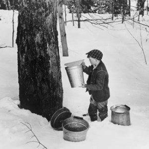
Next week looks like a great week for maple sugaring based on the current forecasted temperatures. We will likely continue to see decent snow melt next week but dewpoints near or below freezing will likely lead to a slow melt instead of a rapid melt.
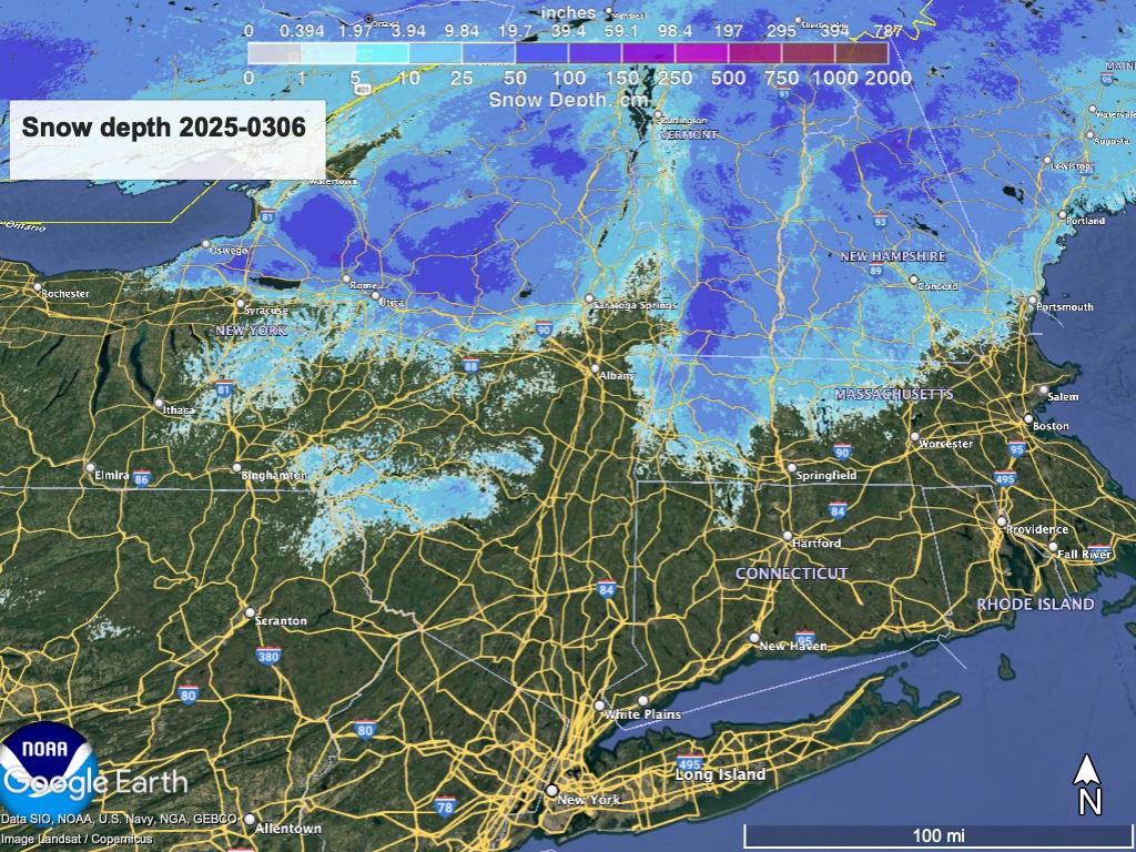
National Weather Service Burlington office, Mar. 6 2025
From the NWS to you, some hope that there will be some skiing through next week. The snowpack’s taken a it of a beating, but it’s still there. Hit up ‘State of the touring centers‘ or in the menu above for reported conditions as of today. Snow depth graphic below:
Forecast
Rain ending Thursday, Southerly winds will shift to come from the west overnight, with some gusts of 40+mph in the downstate thru the Catskills and Hudson Highlands. In the far north temps will begin to drop back to wintry levels, and exiting rain could convert to light snow.
Gusty winds continue and spread across the region Friday, with highest wind speeds from the Catskills through to the southern Green Mountains. Gusts could exceed 50mph. Slightly cooler than Thursday but still above normal temps. Possible rain or show showers. Winds will allow for some lake effect snow,
Saturday-Sunday: Wind gusts abate. A system passes south of NYC early Saturday, and another arrives on Sunday.. Either system could bring a total of 1-2″of snow accumulation. Temps reach their coolest on the weekend and the far north could pick up a bit of snow accumulation. Could be decent skiing if we keep some snow.
Monday – Wednesday: Uncertain possibility of rain or snow showers on Monday but overall generally dry in the southern half of the northeast, The week begins with a warming trend and temperatures heading above normal for this time in the season. By Wednesday temps in NYC will be in the 60s.
The 6-10 day outlook is for very likely above-normal temperatures, and still somewhat likely above normal in the 8-14 day outlook.
Skiing will depend on how much snowpack a given area has left.
| Fr 3/7 | Sa 3/8 | Su 3/9 | Mo 3/10 | Tu 3/11 | We 3/12 | Th 3/13 | |
| Northern NY, VT, NH – Daytime temps | High 20s to low 40s | Mid 20s to mid 30s | High 20s to high 30s | Mid 30s to mid 40s | Mid 40s mid 50s | Mid 40s to mid 50s | Mid 40s to low 50s |
| NYC metro and southern New England coastline – Daytime temps | Mid 40s to low 50s | Low to mid 40s | Low to mid 40s | High 40s to low 50s | High 50s to low 60s | High 50s to low 60s | High 50s to low 60s |
