
Welcome to March – Brrr!

Bad news first – no groomed trail skiing within a couple of hours of NYC. Your go-tos with shortest drive time will be Prospect Mountain, Notchview, and Lapland Lake or Garnet Hill.
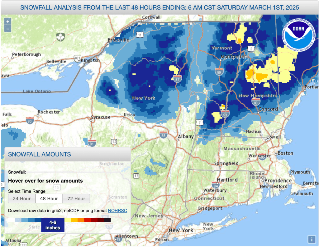
Better news – Such is our late winter that the region north of Albany and I-90 in Massachusett has gotten 4-8″ of snow over the past couple of days. Despite warm temps and even some rain, a very good snowpack remains, and midwinter temps make a brief return.
Worse news ahead: warm weather and heavy rain midweek is likely to cause some real damage to the snowpack. This post is about conditions from February 28 to March 2 2025, and forecast for the next few days. See jump links to Conditions and Forecast.
How’s the skiing in general?
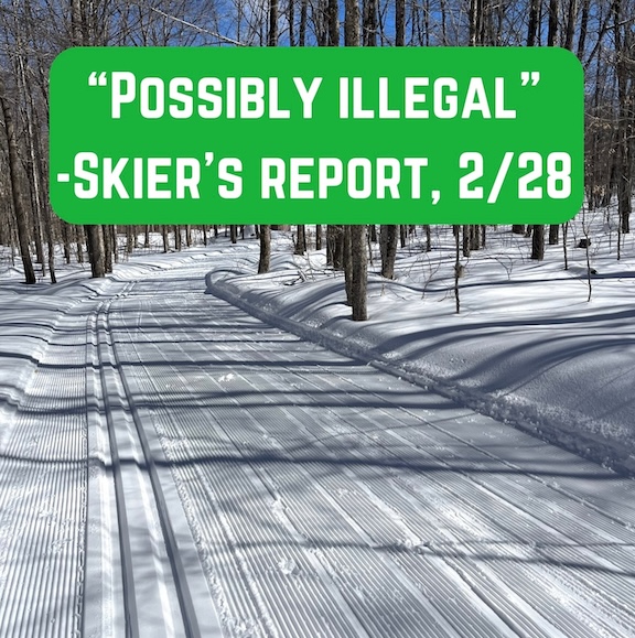
As of March 1: Generally warm weather at the end of February made for very comfortable spring skiing, if a bit damp with freezing rain in spots. Up north, a couple of inches of fresh snow every few days made for fun times and challenging wax choices for classic skiers. BETA report of 2/27 said backcountry was ‘still enjoying pretty stellar mid-winter conditions. ‘
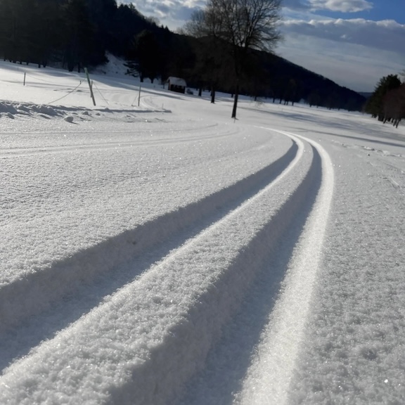
As of March 2: Temps have dropped like a rock starting late Saturday, turning a loose granular surface into frozen granular with chunky spots and some ruts. A few inches of snow have fallen on the Tug Hill and the northern mountains of NY, VT, and NH. With attentive grooming there should be decent if not good skiing today. However the temps and wind mean extra thermal and wind gear, buffs, and lobster mitts for a Sunday ski outing.
By Monday, generally clear skies will help loosen up the surface bit and make for more comfortable skiing. Monday and Tuesday are going to be the best days to ski for the upcoming week – grooming will have had a chance to deal with the frozen trails, temperature will be comfortable, and wind gusts will have abated.
Skiing will undergo a rain delay by Wednesday, and there will be a diminished and soggy snowpack after the low system leaves Thursday. For the weekend, think about the Tug Hill, Adirondacks or northern VT and NH.
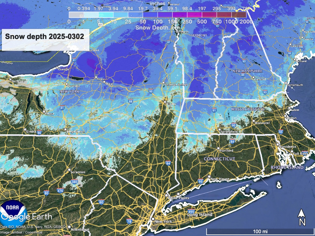
There will be a slight delay today in updating the Google data at ‘State of the touring centers‘ because a few places are having a slow start in grooming or reporting (single-digit temps and icy trail surfaces are not the groomers dream either). Snow depth graphic below:
Not so bad! Well, let’s see what we’ve got on Friday…
Forecast
Cold temps Sunday, yielding to a warmup through the middle of the week. Significant rain during the midweek, then cooler temps and possible snow showers up north for next weekend. This time the bullets will be by day of week:
- Sunday and Monday: Midwinter temps across the northeast. Breezy through Sunday, with winds 15-20mph from West and NW, and gusts as high as 35-40mph. Gusts die down and light winds from South and SW take over in the early part of the week,
- Tuesday: Quietest day of the week, with just a few possible snow or rain showers in the very far north. Monday and Tuesday will likely be the best ski days for the next week or so.
- Wednesday – Thursday: Temps bounce way up and the entire northeast US will see rain. The snowpack will get a pretty good soaking. Rainfall amount could be 1-2″ in the NYC metro and coastal areas as well as central NY. Southern Vermont and the Albany region up to the southern Adirondacks could get 1″ of rain. The far north will get a half-inch or so, and the precipitation could shift over to wintry mix Thursday. Wind gusts could reach 45-50mph, mainly in the southern part of NY and New England.
- Weekend of Mar. 8: Winds calm down again for the next weekend as a weather system arrives along with colder temperatures. There’s a mild chance of light snow Friday into Saturday for northern NY and New England, but accumulation amount and locations are uncertain. Magic 8-ball says: check back later.
| Su 3/2 | Mo 3/3 | Tu 3/4 | We 3/5 | Th 3/6 | Fr 3/7 | Sa 3/8 | |
| Northern NY, VT, NH – Daytime temps | Teens to low 20s | 20s | Mid 30s to low 40s | Mid 40s to low 50s | Low 40s to low 50s | High 20s to high 30s | High 20s to low 30s |
| NYC metro and southern New England coast – Daytime temps | Mid 20s to low 30s | Mid 30s | Mid 40s to low 50s | 50s | High 40s to mid 50s | Low to mid 40s | Low to mid 40s |
Thanks for reading.
