
It feels like we have some more winter to go. Don’t give up hope downstaters.
Light rain converted to snow in most places up north. With a slight to moderate base remianing and new snow on top, it made Saturday a fine day to ski despite the wind. Tonight will be the coldest night of the aseason so far, but as far as snow goes, the NYC metro is once again – ahem – left out in the cold.
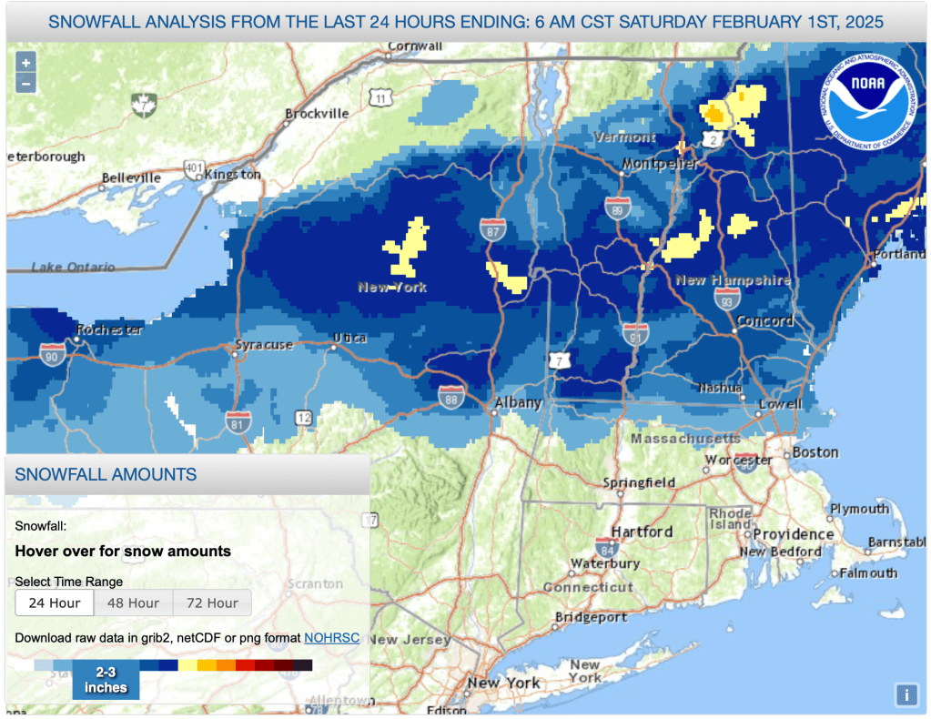
A large swath of the northeast got at least a dusting of snow, and across the Tug Hill and Adirondacks, central Vermont, and the northernmost parts of New Hampshire, 4-8″ of snow accumulated overnight. This amount was more than generally expected.
This post is about conditions for Feb. 2, 2025, and forecast for the next few days. See jump links to Conditions and Forecast.
How’s the skiing in general?
Really great at elevation and toward the northwestern part of the region. Valley areas are a bit thin, but where some hills or mountains were adjacent, a few extra inches on top of the base made a huge difference in skiability. Today was a green wax day for the most part, with fresh snow and cold temps.
BETA report of 1/31 states “6-8″ of new, light powder in the Lake Placid area and upwards of 12″ at Paul Smiths and other areas to the west.”. Conditions will likely have improved with a few inches of additional sn ow last night.
Hit up ‘State of the touring centers‘ or in the menu above for reported conditions as of today. Snow depth graphic below:

Forecast
Overnight Saturday-Sunday is predicted to have the coldest temperatures of the season so far – well below zero degrees Fahrenheit across all of northern NY and New England, and could go down to the single digits in the lower Hudson Valley.
Classic New England winter returns for the upcoming week. Temperature swings will lessen compared to last week’s roller-coaster and settle into normal wintertime ranges. A mix of precipitation will arrive almost every day. The type will change by latititude, elevation, day of week and time of day. Welcome back to normal! Light to mild breezes with string gusty winds at times for the far north, and gnerally across the inland areas on Tuesday and Friday. Gusts could be 25-30mph.
Snow will arrive across most of the northeast Sunday evening and be done by early Monday morning. A mix of snow, wintry mix and rain possible for upstate NY and New England north of Connecticut on Monday as temperatures hit their highs for the week. Remaining precipitation looks to convert snow on Tuesday before ending.
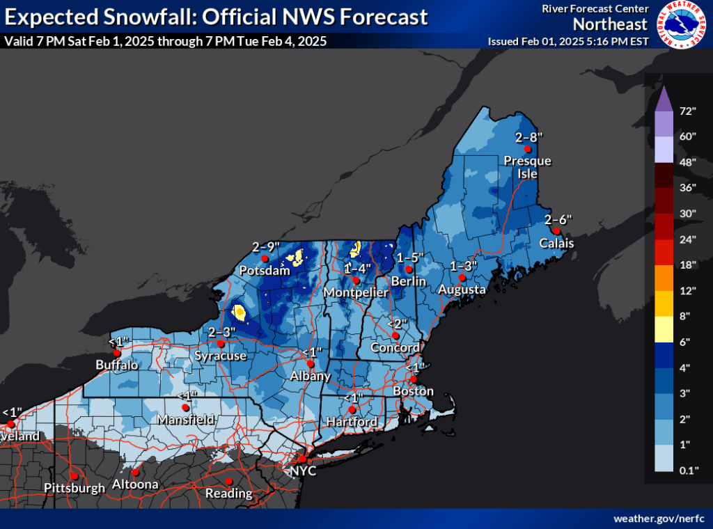
Possible winter storm for the latter half of next week looks to include an ugly mix of snow, wintry mix, ice, and rain starting early Wednesday and lasting all the way through to Friday morning, before converting to snow showers that end on Saturday.

Predicted temperature ranges:
| Daytime temps | Sunday 2/2 | Monday 2/3 | Tuesday 2/4 | Wednesday 2/5 | Thursday 2/6 | Friday 2/7 | Saturday 2/8 |
| Northern NY, VT, NH | 20s | High 30s to low 40s | Mid 20s to low 30s | 20s | Low 30s to low 40s | High 20s to low 30s | 20s |
| NYC metro and coastal New England | 30s | Mid 40s to low 50s | 40s | 30s | 40s | High 30s to low 40s | 30s |
That’s it for now. Happy Groundhog Day. Thanks for reading.
