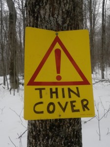
Not much joy in store for the downstate XC skier, but we may get some snow flurries to spark the imagination and wax those rock skis!

Don’t like the sound of gravel and mulch on P-tex? Head to Prospect Mountain or one of the Osceolas. Conditions in some parts up north are perfect.
This post is about conditions for Jan. 16 2025, and forecast for the next few days. See jump links to Conditions and Forecast.
How’s the skiing in general?
The resorts are putting in extra effort ahead of the holiday weekend to buff up those trails and tracks, so take advantage of them if you can! Meanwhile, the places that can’t afford or don’t have trails wide enough for. a Pisten Bully are taking the luck they have and making the most of it. Bottom line: go skiing.
BETA report of 1/13 says the Jackrabbit Trail, and the backcountry tours on roads should be good.
Hit up ‘State of the touring centers‘ or in the menu above for reported conditions as of today.
Forecast
Light snow in the north country, a light dusting possible for the NYC metro by the end of Sunday. Temperatures will rise through Saturday, then drop to authentically chilly temperatures by Wednesday (some parts of the north country could be below zero). Little snow predicted, but any flurries will still be nice to see.
Snow flurries and light snow Friday across the region. A system will bring more precipitation starting Saturday afternoon and lasting through Sunday. The precipitation will start with rain and showers south of the VT-MA border, and snow or wintry mix north of that boundary.
By Sunday temperatures start falling and the southern regions may get some snow showers or actual snow accumulation as well before the end of the weekend. Winds will be directionally variable but steady at 10-20mph on Saturday with some very strong gusts of 50mph in the far northern areas of NY and New England. Winds will become milder and come from the south on Sunday,
From Monday through the midweek the northeast will be chilly and cold, and most snowfall will be lake effect snow for upstate New York and the Northeast Kingdom of Vermont. Although winds will be mild overall, Monday will have gusts of 20+mph.; combined with the chill, it could feel downright uncomfortable. Temperatures begin warming a bit late in the week. Winds will once again pick up and be gusty on Thursday.

The probabilities of real accumulation aren’t great, but there’s a reasonable chance for ate last a dusting of snow across most of interior New England and New York.
| Daytime temps | Friday 1/17 | Saturday 1/18 | Sunday 1/19 | Monday 1/20 | Tuesday 1/21 | Wednesday 1/22 | Thursday 1/23 |
| Northern NY, VT, NH | High 20s to low 30s | 30s | 20s | Teens | Single digits to teens | Teens | Teens to low 20s |
| NYC metro and coastal New England | High 30s | 40s | 30s | 20s | Teens to low 20s | Teens to low 20s | Mid to high 20s |
Thanks for reading.
