
Mother Nature is being stingy and selective in handing out snow. But slight refreshes are helping keep what cover there is decent enough for good skiing.
This post is about conditions for Jan. 11, 2025, and forecast for the next few days. See jump links to Conditions and Forecast.
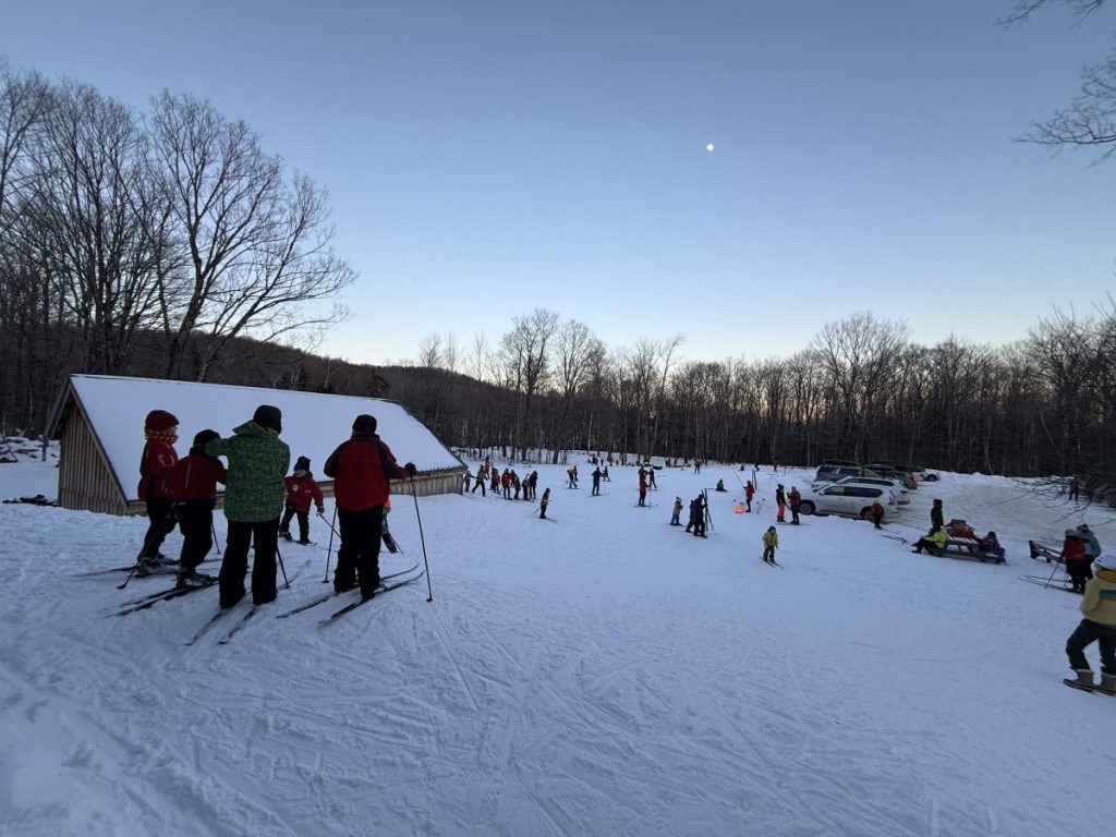
How’s the skiing in general?
Sometimes it’s good to track conditions on the days when touring centers focus for maximum effect. while cover remains thin, there’s good skiing where some recent dustings of snow have refreshed the base. For really great cover you have to head to the Tug Hill.
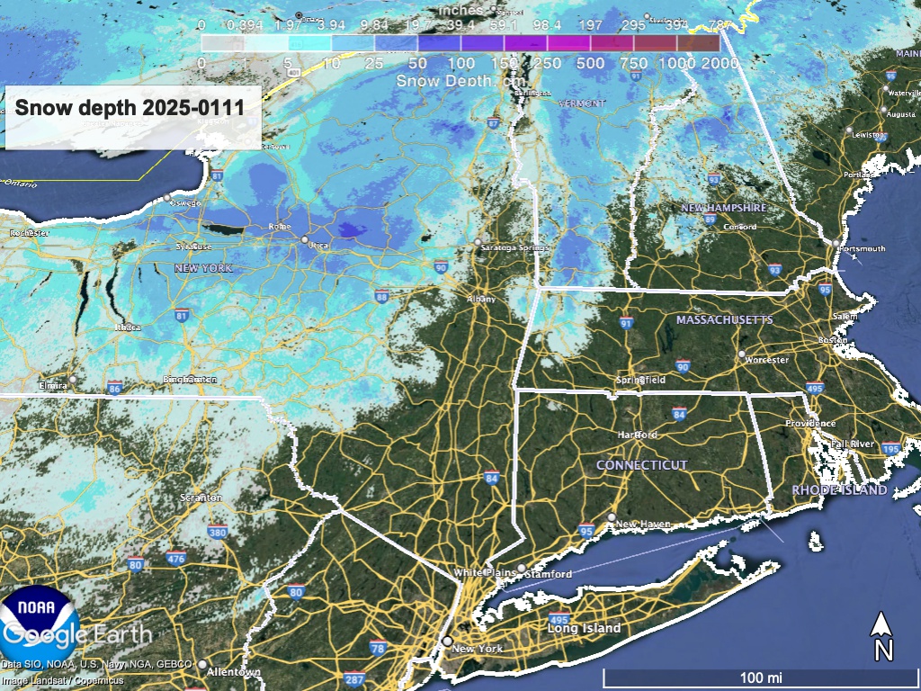
Hit up ‘State of the touring centers‘ or in the menu above for reported conditions as of today. Snow depth graphic below:
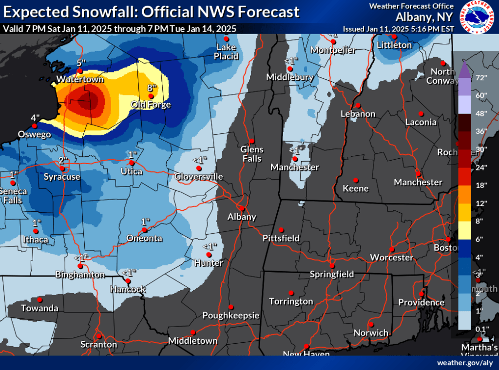
Forecast
Light snow Saturday due to cold temps and westerly winds. Sunday should be dry. Chances of light snow through the week for the far north. For the lucky areas a few dustings of snow will help keep conditions very nice. Temperatures will be slightly above normal for the recent days on Sunday
Starting late Monday or early Tuesday, lake effect driven snow kicks off what could be a few days with some light snowfall, mostly for upstate NY and northern VT. Greatest accumulations will be just east of the Great Lakes, including the Tug Hill, High Peaks of the Adirondacks, and northern Green Mountains.
There is no strong storm system expected, but a Canadian clipper system will enter from the west and a cyclonic air pattern will bring some warmer air up from the southwest. Temperatures could be a bit colder with gusty winds of 20-30mph in the midweek before warming ahead of the following weekend.
| Daytime temps | Sunday 1/12 | Monday 1/13 | Tuesday 1/14 | Wednesday 1/15 | Thursday 1/16 | Friday 1/17 | Saturday 1/18 |
| Northern NY, VT, NH | Mid 20s to low 30s | High 20s to mid 30s | 20s | Low to mid 20s | 20s | Mid 20s to low 30s | 30s |
| NYC metro and coastal New England | Mid 30s to low 40s | High 30s to low 40s | High 20s to low 30s | High 20s to low 30s | High 20s to low 30s | Mid to high 30s | 40s |
