

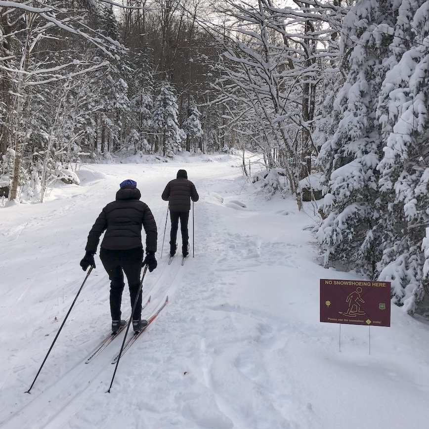
Tug Hill and the Osceolas are the best bet although not quite as close as Prospect Mountain. Conditions have been good and should be very skiable despite the wind.
This post is about conditions for Jan. 8 2025, and forecast for the next few days. See jump links to Conditions and Forecast.
How’s the skiing in general?
Thin cover for the most part, but some nice exceptions like the Tug Hill and Prospect Mountain, Lapland Lake, Wild Wings, Trapp Family Lodge. Luck of snowfall and attention to grooming makes the difference.
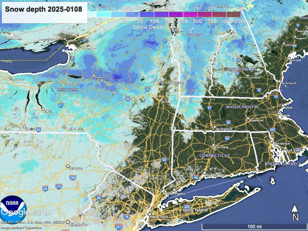
Aside from the wind abating, conditions are not likely to get much better during the next few days. Hit up ‘State of the touring centers‘ or in the menu above for reported conditions as of today. Snow depth graphic below:
Forecast
20s are cool, teens are chilly. Will over wind chill.
Blustery winds and lake effect driven snow for central and upstate New York all day today and extending into Thursday. Greatest accumulations will be in areas immediately east of the Great Lakes. Light snow will reach across to the northern Green Mountains in Vermont, but accumulations will be light otherwise. Winds will be westerly and generally 20-30mph. Gusts could be 40-50mph in the Catskills, Hudson Highlands, and western Connecticut. Milder gusts of 30-35mph up north.
Winds will abate by Friday, and by early morning Saturday, a system will be passing off the Carolinas south of the NYC metro. There is a chance of snow showers across much of the northeast US, but greatest accumulations will be in central and upstate New York.
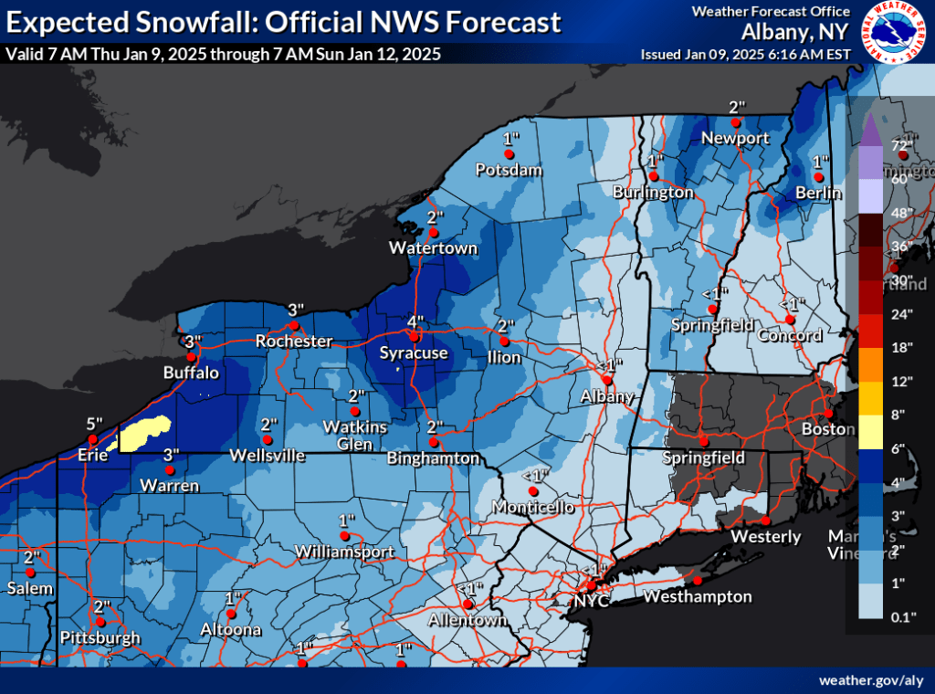
Sunday should be dry. A polar vortex off the western end of the Great Lakes could channel some snow into the region Monday, No significant accumulations expected so far, and snowfall will mainly be confined to areas near the Great Lakes.
| Daytime temps | Wednesday 1/8 | Thursday 1/9 | Friday 1/10 | Saturday 1/11 | Sunday 1/12 | Monday 1/13 | Tuesday 1/14 |
| Northern NY, VT, NH | Teens to low 20s | Teens to mid 20s | 20s | 20s | Mid 20s to low 30s | Mid 20s to low 30s | Teens to low 30s |
| NYC metro and coastal New England | 20s | Mid 20s to low 30s | 30s | 30s | 30s | Mid to upper 30s | 30s |
