
We’ve got the temperatures back- now we need the snow. Good skiing in the Northeast Kingdom of Vermont and in the Tug Hill, but pretty marginal elsewhere. A couple of systems coming tonight and tomorrow may provide a bit of snow in the far north and in the NYC metro.
This post is about conditions for Jan. 3, 2025, and forecast for the next few days. See jump links to Conditions and Forecast.
How’s the skiing in general?
Thin cover in many spots except where significant snowfall refreshed the snowpack. The good news is there will be stable wintertime temperatures for the next week- a rare occurrence for the northeast.
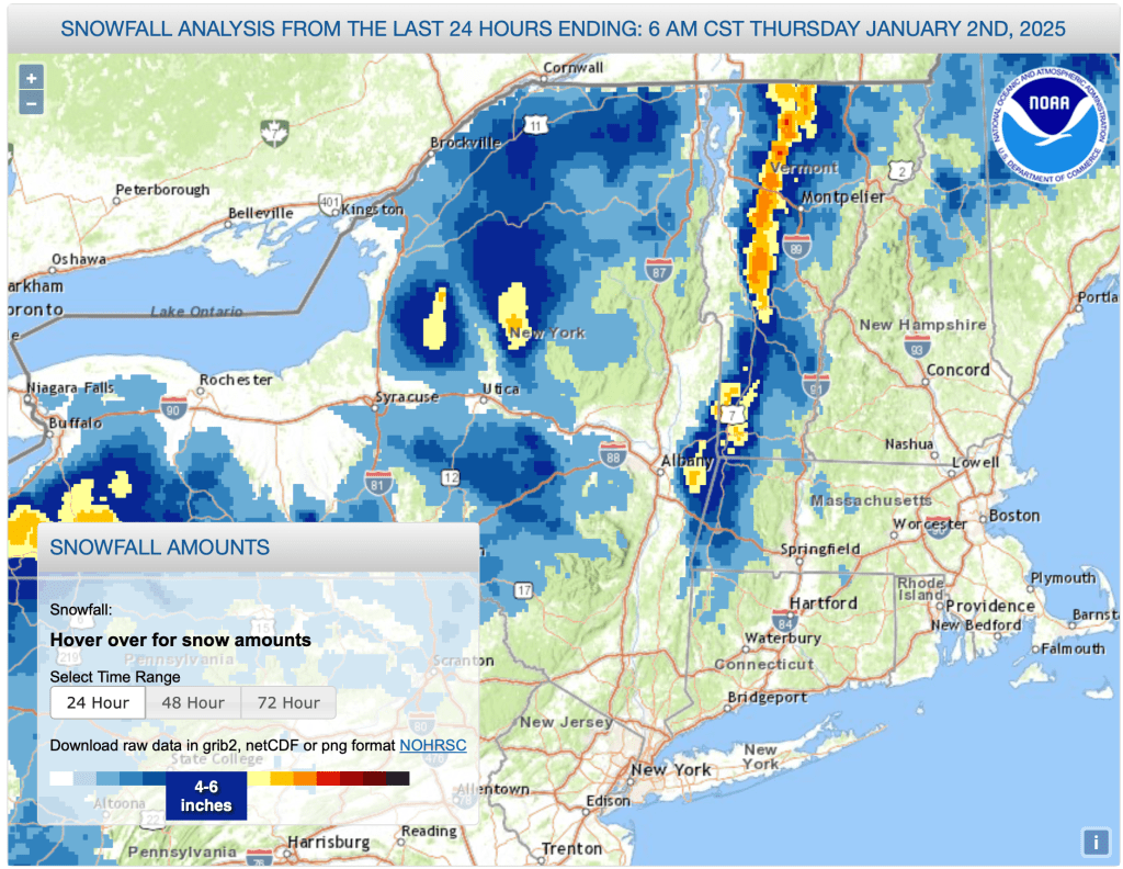
Hit up ‘State of the touring centers‘ or in the menu above for reported conditions as of today. Yesterday’s snowfall immediately below, and snow depth graphic follows.

Forecast
Winter temperatures, and no major snowstorms predicted. Lake effect snow across NY State through to Vermont into early next week.
Winds are still gusty, up to 25-30mph up north, milder in the south. The winds will taper off on Saturday, coming in from the west. Gusts will moderate over the weekend, but still strong in spots..
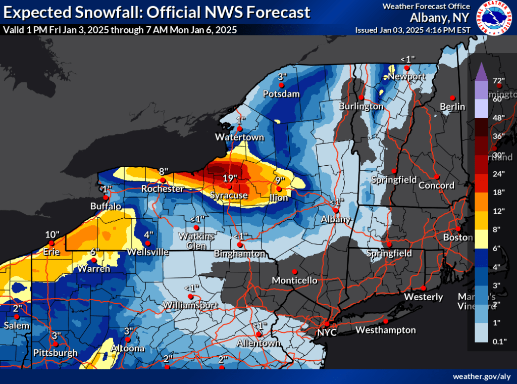
Down in the southern areas, we might catch a bit of snow from a system hitting the other Mid-Atlantic states and Washington DC later today. Meanwhile, the mountains of NY and northern VT could pick up several inches of primarily lake effect driven snow over the weekend, but accumulations will be slight in the valleys and east of the Green Mountains. Here’s a look at probable weekend snowfall amounts below. Syracuse and the area just north of it could get dumped with more than a foot of snow this weekend:
For next week, generally dry weather, with some possible light snow for upstate NY and VT by Thursday. Winds will be milder except for midweek when gusts could pick up to 3-35mph. Daytime temperatures will be very much the same through the week. Good for keeping what snow there is, and for cranking up the snowguns.
Weather to come.
| Daytime temps | Saturday 1/4 | Sunday 1/5 | Monday 1/6 | Tuesday 1/7 | Wednesday 1/8 | Thursday 1/9 | Friday 1/10 |
| Northern NY, VT, NH | Teens to mid 20s | Teens to mid 20s | Teens to mid 20s | Teens to low 20s | Teens to low 20s | Teens to low 20s | 20s |
| NYC metro and coastal New England | Low to mid 30s | Low to mid 30s | High 20s to low 30s | High 20s to low 30s | High 20s to low 30s | High 20s to low 30s | 30s |
