
…and that’s right around the corner! Snow in the forecast for portions of northern NY State and Vermont. As the saying goes: ‘if you don’t like the weather now, just wait a minute’
How’s the skiing?
With the rain and warm weather, more like ‘water-skiing’. But some of the never-say-die centers are till saying ‘come on out’. Hit up ‘State of the touring centers‘ or in the menu above for reported conditions as of today.
Forecast for the rest of the week
There’s a cooling trend coming for the weekend, with wintertime temps expected in the north.
Rain is ending for now, but another system wil bring rain starting Tuesday. As temperatures cool overnight, some areas of the Adirondacks and northern Vermont will see a changeover to freezing rain or even snow on Wednesday. The changeover will broaden by Wednesday afternoon, assisted by lake effect snow that will continue through much of the weekend.
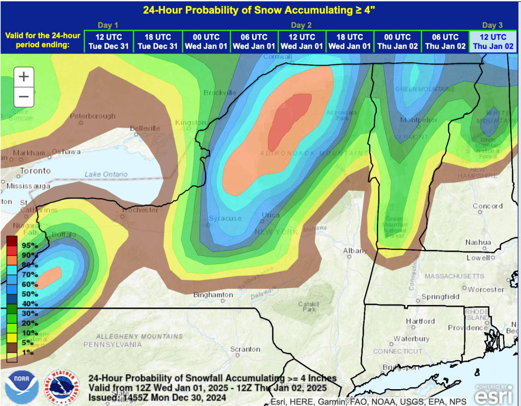
There’s a good chance the Tug Hill and Adirondacks will see more than 4″ of snow by Thursday morning:
We’ll be in for some breezy and gusty days starting off the New Year, with speeds of 10-15mph, and gusts over 25 or even 30mph. The snow we get is going the bet windblown too, so rouring centers might need to take Thursday to assess, pick up fallen trees, and groom late that day or Friday morning.
