
Looking for snow this week? Head north to the High Peaks, Northeast Kingdom of Vermont, or the tippy-tippy top of New Hampshire.

Hit the road for to find the snow
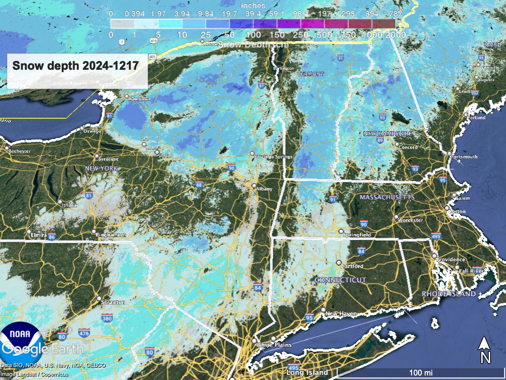
This post is about conditions for Dec. 17 2024, and forecast for the next few days. See jump links to Conditions and Forecast.
How’s the skiing in general?
The writing is on the wall – trails have softened up rapidly, and even though not all areas have updated yet for the day, we can say with some certainty most areas will give the trails a rest day today, and likely Wednesday.
Hit up ‘State of the touring centers‘ or in the menu above for reported conditions as of today. Snow depth graphic below:
Forecast
Warm weather and some rain today and tomorrow will give way for colder temperatures and added precipitation late Wednesday into Thursday. The northern areas will likely see some snow from this later system, but the forecast for accumulation of 4″ or more centers in the mountains of the norhern Adirondacks and New England.

There’s a second shot at some snow showers more generally for the early part of the weekend, as some kind of weather system mixes with cold air from the west and north. Dress warmly for the weekend, as we will get the coldest weather of the season so far, but forecasts are that while we are looking for snow showers on the weekend, there won’t be much accumulation. Expect some decent lake effect snow could fall in the immediate vicinity of the Great Lakes, and stay tuend as there’s time for the weather pattern to change in a more skiable way.
| Daytime temps | Tuesday 12/17 | Wednesday 12/18 | Thursday 12/19 | Friday 12/20 | Saturday 12/21 | Sunday 12/22 | Monday 12/23 |
| Northern NY, VT, NH | Low 40s to low 50s | Mid 30s to low 40s | High 20s to high 30s | Mid 20s to low 30s | Teens to high 20s | Single-digits to teens | Teens to low 20s |
| NYC metro and coastal New England | 50s | Mid 40s to low 50s | 40s | High 30s to low 40s | 30s | 20s | High 20s to low 30s |
