
This feels like the earliest start to the season in years for many touring centers all at once
High Point might be skiable due to the amount of snow the received, but they remain officially closed for now. Next closest places to ski will be Prospect Mountain and Notchview. Looks like Lapland Lake has mounted a good grooming effort, possibly having receivd more snow.
The west is up, and the East is down (in terms of temperature compared to normal). A polar vortex has been able to slide around and deliver cold air to the midwest and eastern U.S., simulltaneously allowing warmer air to crep into the west and Rocky Mountain states. This explains some of the pattern we’ve seen over the past week, and will continue to see for the upcoming week.
This post is about conditions for Nov. 20 2024, and forecast for the next few days. See jump links to Conditions and Forecast.
Conditions
‘Early season conditions’ is what some places are calling it- soft wet snow, thin cover in spots, rock ski advisory because ther’s no base under that snow.
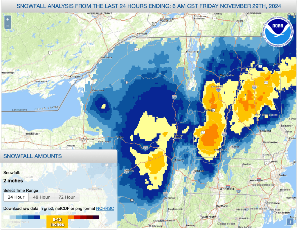
Below is a graphic showing snowfall from Thursday last week. Snowfall was widespread in the higher elevations, but lacking a base, there’s not a lot to work with when it settles:
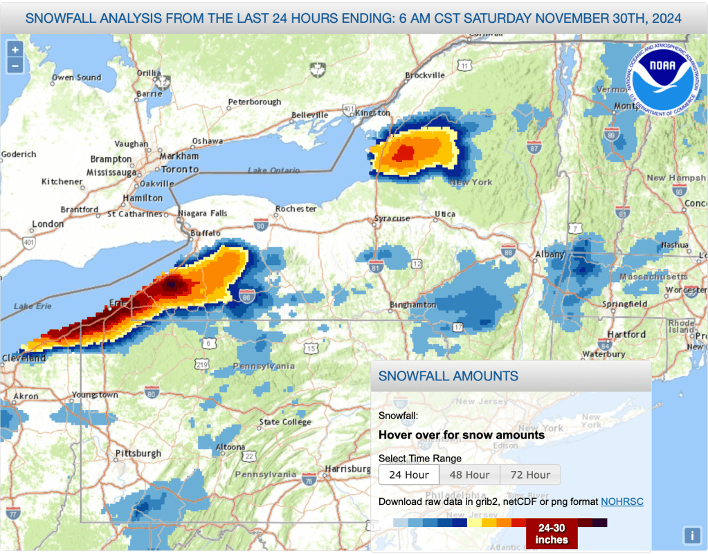
Here’s an image showing extermely heavy but isolated lake effect snow Friday. The bands were limited in area that the Osceola ski areas were left out of it despite being very close to the epicenter of some really big snowfall accumulations:
Forecast
For the end of the holiday weekend and early next week, locally heavy lake effect snow will continue through Monday for portions of New York State adjacent to the Great Lakes. Some spillover accumulation as far as the Adirondacks. Otherwise, clear conditions with temperatures expected to be 5-10 degrees below normal for this time of year.
Daytime temperatures in elevated areas of northern New York and New England will be just above freezing in the early part of the week. A brief bump up in termpeatures in the midweek will then be followed by colder air that will bring temps well below freezing for inland parts of the northeast.
By Wednesday evening, a Canadian Clipper will begin moving in, brining light precipitation and much colder air by Friday. The precipitation will fall as rain/snow in the southern and coastal regions fo the northeast, and light snow inland and to the north. The temperature gradient between incoming and outgoing systems will create gusty and blustery winds on Friday.
| Daytime temps | Sunday 12/1 | Monday 12/2 | Tuesday 12/3 | Wednesday 12/4 | Thursday 12/5 | Friday 12/6 | Saturday 12/7 |
| Northern NY, VT, NH | High 20s to low 30s | High 20s to low 30s | High 20s to low 30s | High 20s to mid 30s | 30s | 20s | Teens to mid 20s |
| NYC metro and coastal New England | Mid 30s to low 40s | Mid 30s to low 40z | Mid 30s to low 40z | High 30s to mid 40s | 40s | 30s | High 20s to mid 30s |
Prep those rock skis! Thanks for reading.
