
Can it really be that time of the season already?

This post is about conditions for Feb. 29, 2024, and forecast for the next few days. See jump links to Conditions and Forecast.
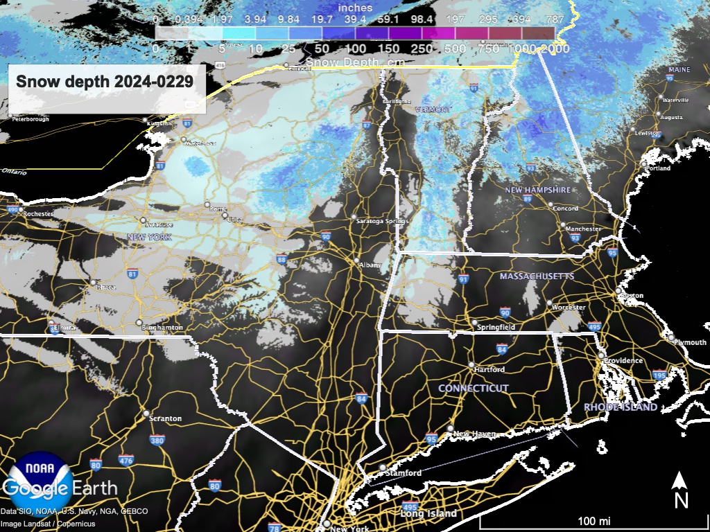
Conditions
Hard, fast, and icy on the trails up north, but just wait- things are warming up quickly. If there were more of a snowpack, that would mean spring skiing. Unfortunately Mother Nature seems to have other plans. Without a serious turn in temperature, and a spring snowstorm, operations at touring centers will shut down pretty soon.
Minimally skiable conditions at a few places with manmade loops (Mount van Hoevenberg, Rikert, Oak Hill, Mountaintop, Craftsbury, Jackson STF) and best-effort grooming at the others that are still allowing skiers on the trails (Paul Smith, Garnet Hill, Lapland Lake, Trapp Family Lodge, Woodstock).Even in the White Mountains, where the snow cover warrants the effort, they are working hard to scratch through the frozen surface to create something skiable.
Hit up ‘State of the touring centers‘ or in the menu above for reported conditions as of today. Snow depth graphic below:
Forecast
Gusty winds and cool weather today bring light lake effect snow to northern New England and interior areas of New Yor State. Wind gusts of 30-35mph expected. Otherwise dry and variably cloudy skies.
Rain and wintry mix arrive with a system coming from the south Friday night. It will verspread the northeast overnight into Saturday, becoming all rain. Rainfall not expected to be heavy, but the heaviest of the rain showers will be south of the Adirondacks, Green, and White Mountains. Rain exits on Sunday.
An ‘unsettled’ weather pattern starts the workweek off, and could bring coastal showers on Monday that may overspread the inland regions by Tuesday. This weather pattern looks to continue through midweek.
A cold front will arrive sometime around the midweek to meet a system from the south. Weather will probably continue to be unseasonably mild so it could mean rain rather than snow.
Niether the 6-10 day nor 8-14 day outlook of temperature seems promising, but keep your fingers crossed that the fat guy isn’t yet ready to sing the last aria of the season.
| Daytime temps | Thursday 2/29 | Friday 3/1 | Saturday 3/2 | Sunday 3/3 | Monday 3/4 | Tuesday 3/5 | Wednesday 3/6 |
| Northern NY, VT, NH | Mid 20s to low 30s | High 30s to low 40s | Mid- to high-40s | 50s | High 50s to low 60s | 50s | High 40s to low 50s |
| NYC metro and coastal New England | High 30s to low 40s | Mid- to high-40s | High 40s to low 50s | High 50s | High 50s to low 60s | 50s | Low- to mid-50s |
Adding the nighttime lows for decision suport for the early bird.
| Low temps (early AM on date) | 2/29 | 3/1 | 3/2 | 3/3 | 3/4 | 3/5 | 3/6 |
| Northern NY, VT, NH | Teens to high 20s | Teens to low 20s | High 20s to low 30s | 30s | Mid 30s to low 40s | Mid 30s to mid 40s | Mid 30s to low 40s |
| NYC metro and coastal New England | High 20s to mid 30s | Low- to mid-20s | Low- to mid-30s | 40s | Low- to mid-40s | High 30s to mid 40s | High 30s to mid 40s |
